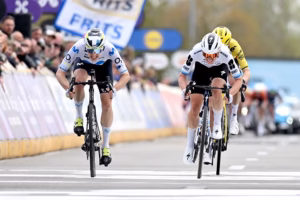
The Sea-to-Sky Highway, officially designated as Highway 99, unfurls along one of the world’s most dramatic coastal corridors, stretching 135 kilometres from Vancouver through Squamish to Whistler. This engineering marvel, carved between the turquoise waters of Howe Sound and the towering Coast Mountains, offers cyclists an unparalleled journey through temperate rainforest, past cascading waterfalls, and beneath glaciated peaks. For those who view cycling not merely as transportation but as profound communion with landscape, the Sea-to-Sky corridor represents British Columbia’s premier road cycling experience, a route that demands respect and rewards with memories etched as deeply as the glacier-carved valleys themselves.
Much like exploring cycling destinations across continents, the Sea-to-Sky corridor offers travel-led cycling where the bike becomes the perfect vehicle for experiencing coastal mountain terrain at human speed, rich in detail and natural grandeur that simply cannot be appreciated from behind car windscreens.

The Route: Highway 99 North
The Sea-to-Sky Highway is not simply a road connecting cities. It is a meticulously planned transportation corridor through the UNESCO Biosphere Region, completed with widened shoulders and improved safety features following Vancouver’s 2010 Winter Olympics hosting. The route traverses traditional territories of the Squamish Nation, whose connection to these lands and waters stretches back millennia.
Route Specifics:
- Total distance: 135 kilometres (84 miles) from Horseshoe Bay (West Vancouver) to Whistler
- Horseshoe Bay to Squamish: 48 kilometres, 640 metres elevation gain
- Squamish to Whistler: 58 kilometres, 1,100 metres elevation gain
- Total elevation gain: Approximately 1,740 metres northbound
- Average gradient: 2-4% sustained climbing with steeper sections 6-8%
- High point: Approximately 650 metres at Whistler
- Difficulty level: Challenging, due to distance, sustained climbing, and traffic
- Season: May through October optimal, year-round possible for hardy cyclists
- Traffic considerations: Heavy recreational vehicle and tourist traffic June-September
Designated by National Geographic amongst the world’s most scenic drives, the Highway becomes transcendent when experienced by bicycle. Every gradient, every shift in temperature carrying ocean mist upward into mountain air, and every wildlife encounter becomes immediate and visceral.
Strategic Route Characteristics
Northbound riding (Horseshoe Bay to Whistler) offers strategic advantages:
- Net elevation gain: Consistent climbing makes for dramatic descent returning southbound
- Wind patterns: Generally favourable with prevailing winds from southwest
- Viewpoints: Better positioned for northbound cyclists (pull-offs on right side)
- Gradients: Steady climbs rather than punishing ramps
- Services: Strategically spaced for refuelling and rest

Vancouver: Urban Cycling Paradise
Before embarking on the Sea-to-Sky journey, Vancouver itself offers world-class urban cycling infrastructure worth exploring.
The Seawall: World’s Longest Uninterrupted Waterfront Path
The Vancouver Seawall stretches 28 kilometres around Stanley Park, False Creek, and English Bay, creating the world’s longest uninterrupted waterfront path.
Stanley Park Seawall Loop:
- Distance: 9 kilometres (one-way around park)
- Elevation: Essentially flat
- Highlights: Lions Gate Bridge views, Prospect Point, Siwash Rock, Second Beach
- Facilities: Multiple bike rental locations at park entrance
The Seawall provides a spectacular introduction to Vancouver’s cycling culture, with dedicated separated paths for cyclists and pedestrians. On sunny days, thousands of cyclists, inline skaters, and pedestrians share this iconic route.
Urban Greenways and Dedicated Paths
Vancouver’s extensive network of separated cycle paths creates a comprehensive urban cycling infrastructure:
- Arbutus Greenway: 9 kilometres north-south through residential neighbourhoods
- Central Valley Greenway: 24 kilometres connecting Vancouver to Burnaby, New Westminster
- Ontario Street Bikeway: Key north-south route through city centre
- Seaside Greenway: Additional waterfront routes beyond Stanley Park
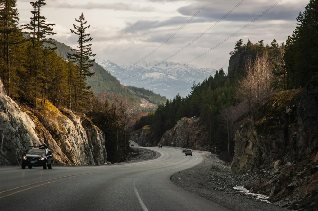
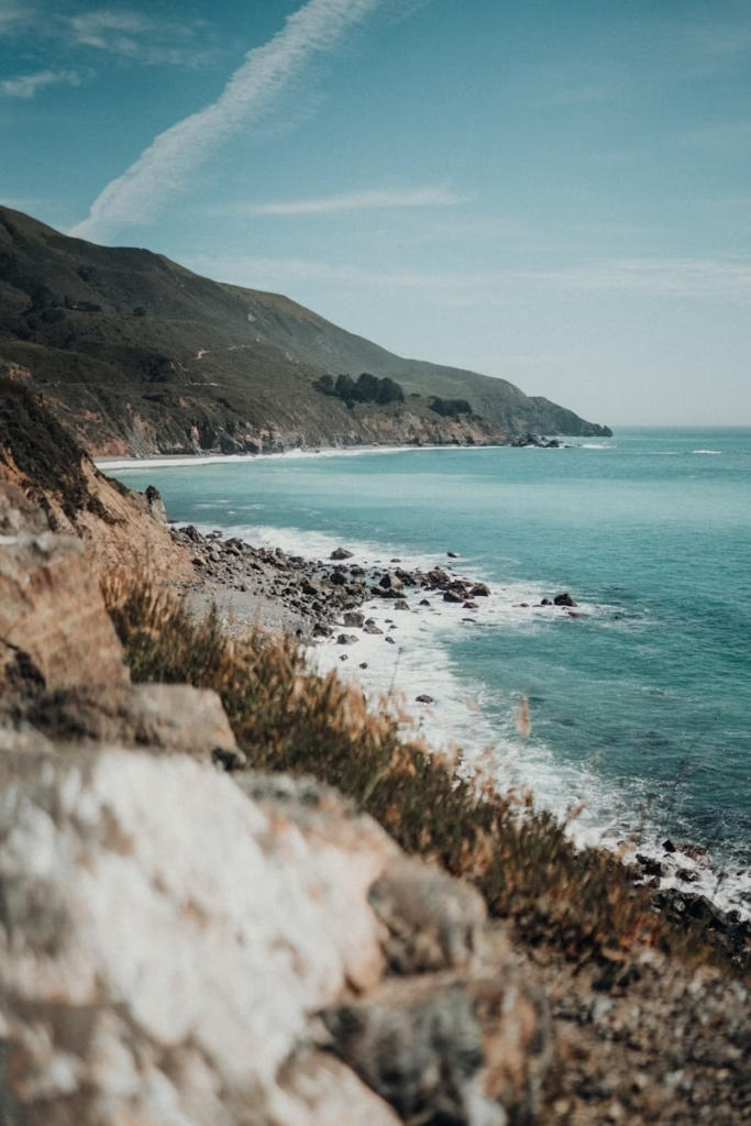
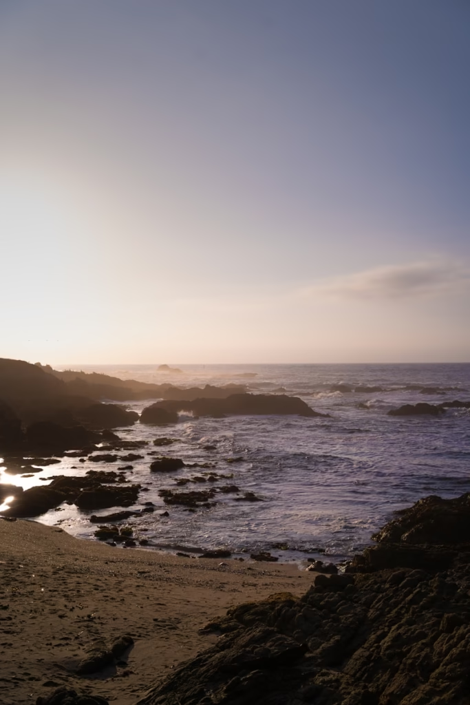
Horseshoe Bay to Squamish: The Coastal Section (48km)
The journey proper begins at Horseshoe Bay, a charming ferry terminal village in West Vancouver. This opening section hugs the steep cliffs of Howe Sound, offering continuous coastal vistas whilst navigating challenging terrain.
Kilometre 0-15: Horseshoe Bay to Lions Bay
The immediate climb from Horseshoe Bay establishes the route’s character, a sustained 3-4% gradient hugging cliffsides high above Howe Sound.
Key features:
- Kilometre 5: Porteau Cove Provincial Park (camping, picnic area, scuba diving site)
- Kilometre 12: Brunswick Beach access
- Kilometre 15: Lions Bay village (small community, limited services)
Critical considerations:
- Narrow shoulders on some sections
- Scenic pullouts for viewing Howe Sound
- Heavy traffic, particularly summer weekends
- Brilliant ocean views toward Vancouver Island
The turquoise waters of Howe Sound, actually a glacially-carved fjord, provide constant visual accompaniment. On clear days, Vancouver Island’s mountains shimmer on the western horizon.
Kilometre 15-35: Lions Bay to Britannia Beach
Sustained climbing continues through temperate rainforest, with Highway weaving between coastal cliffs and mountain bases.
Key features:
- Kilometre 25: Murrin Provincial Park (rock climbing destination, small lake)
- Kilometre 33: Britannia Beach (historic copper mining village)
- Britannia Mine Museum: Major attraction showcasing mining heritage
This section offers more varied terrain with brief flatter stretches allowing recovery between climbs. The forest canopy provides welcome shade during warmer months.
Kilometre 35-48: Britannia Beach to Squamish
The approach to Squamish delivers increasingly dramatic mountain scenery, with the Stawamus Chief (the second-largest granite monolith in world) dominating views.
Key features:
- Kilometre 42: Shannon Falls Provincial Park (335-metre waterfall, BC’s third highest)
- Kilometre 43: Stawamus Chief Provincial Park (iconic rock climbing and hiking destination)
- Kilometre 44: Sea to Sky Gondola access
- Kilometre 48: Squamish town centre
Shannon Falls stop: Easy 5-minute walk from the highway to the viewing platform makes this an essential photo opportunity. The falls thunder year-round, most impressive during spring runoff.
Sea to Sky Gondola: 10-minute gondola ride ascends 885 metres to the summit lodge with spectacular views. Popular for non-cyclists in group, or recovery day activity. Rates: CAD $62 adults.
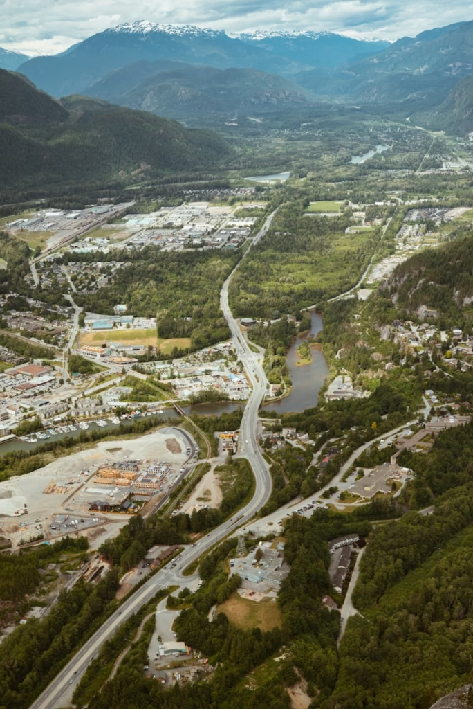
Squamish: The Outdoor Recreation Capital
Squamish (population 23,000) serves as a strategic halfway point and has emerged as a destination in its own right, particularly for mountain biking and rock climbing.
Squamish as Cycling Hub
Urban cycling infrastructure:
- Expanding network of dedicated paths
- Squamish Valley Road (quiet, flat valley riding)
- Paradise Valley Road (accessed via Squamish Valley)
- Access to world-class mountain bike trail networks
Mountain Biking Paradise: With over 300 kilometres of purpose-built singletrack, Squamish consistently ranks amongst world’s top mountain bike destinations. Famous trail networks include:
- Alice Lake area: Half Nelson, Pseudo-Tsuga, Angry Midget
- Smoke Bluffs: Technical riding close to town
- Diamond Head area: High-alpine trail access
Squamish Services and Amenities
Bike shops and rentals:
- Dialed In Cycling: Premium mountain bike and e-bike rentals, guiding services, on-site accommodation at MTN Fun Basecamp
- Blazing Saddles Adventures: Multiple bike types, tours
- Bluebird Tuning: Rentals, service, coffee shop
Accommodation:
- Squamish Adventure Inn: CAD $120-180, cyclist-friendly
- Executive Suites Hotel & Resort: CAD $150-250, full kitchens
- MTN Fun Basecamp: CAD $80-140, cabin-style rooms, campground hotel at Dialed In Cycling location
Dining:
- Watershed Grill: Upscale dining, local ingredients
- Howe Sound Brewing: Craft beer, pub fare
- The Salted Vine: Wine bar, tapas
- Numerous cafés along Cleveland Avenue (main street)
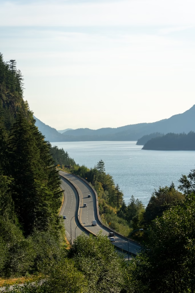
Squamish to Whistler: The Mountain Section (58km)
The second leg delivers the most sustained climbing and arguably the most spectacular mountain scenery, ascending from sea-level influence into high Coast Mountain environment.
Kilometre 48-70: Squamish to Brandywine Falls
Steady climbing through Cheakamus Canyon reveals increasingly alpine character, with views of the Tantalus Range dominating western vistas.
Key features:
- Kilometre 52: Cheakamus River viewpoint
- Kilometre 60: Function Junction (Whistler’s industrial area, services available)
- Kilometre 62: Callaghan Valley Road junction (access to Whistler Olympic Park)
- Kilometre 68: Brandywine Falls Provincial Park
Callaghan Valley option: 14-kilometre side trip (one-way) to Whistler Olympic Park, site of 2010 Winter Olympics Nordic events. Excellent training ride with sustained climbing, quieter than Highway 99.
Brandywine Falls: Quick 1-kilometre return walk to 70-metre waterfall viewing platform. Essential stop, particularly impressive during summer melt.
Kilometre 70-106: Brandywine Falls to Whistler
Final ascent into Whistler brings relief as the gradient moderates, with anticipation of the journey’s end providing a psychological boost.
Key features:
- Kilometre 80: Alpha Lake area, first glimpse of Whistler peaks
- Kilometre 90: Creekside (Whistler’s original base area)
- Kilometre 95: Village Gate Boulevard (entrance to Whistler Village)
- Kilometre 106: Whistler Village centre
The approach through Creekside and into Village reveals Whistler’s dual character: rugged mountain environment transformed into world-class resort infrastructure whilst maintaining connection to wilderness.

Whistler: Mountain Resort and Cycling Destination
Whistler (permanent population 13,000, swelling to 40,000+ peak season) marks the journey’s triumphant conclusion, offering recovery amenities and extending riding opportunities.
Whistler Cycling Infrastructure
Valley Trail System: 40+ kilometres of paved, car-free pathways connecting all Whistler neighbourhoods, parks, and lakes. Perfect for recovery rides, family cycling, or commuting between accommodation and restaurants.
Key Valley Trail sections:
- Lost Lake loop: 4 kilometres, mostly forested
- Green Lake loop: 12 kilometres, stunning mountain views
- Meadow Park to Village: 6 kilometres, river valley
Road Cycling from Whistler
Whistler serves as base for numerous road cycling routes extending into backcountry.
Popular routes:
- Pemberton Valley (Highway 99 north): 33 kilometres one-way, gradual climbing, agricultural valley views
- Callaghan Valley to Olympic Park: 14 kilometres one-way, quiet road, sustained climbing
- Joffre Lakes (beyond Pemberton): 100+ kilometres return, serious climbing to spectacular glacial lakes
Whistler Cycling Club: Local club organises regular group rides, welcomes visitors. Check whistlercyclingclub.ca for schedule.
Whistler Mountain Biking
Whistler Bike Park, consistently rated world’s top lift-accessed mountain bike park, operates late May through mid-October.
Bike Park highlights:
- 70+ trails ranging beginner to expert
- Over 1,500 metres vertical descent
- Lift-accessed (no climbing required)
- Rental bikes and instruction available
For those recovering from road cycling efforts, riding the Bike Park offers a completely different experience, showcasing Whistler’s diverse cycling culture.
Whistler Accommodation
Luxury options:
- Fairmont Chateau Whistler: CAD $400-800, ski-in location, spa, multiple restaurants
- Four Seasons Whistler: CAD $500-1,000, luxury rooms, exceptional service
- Nita Lake Lodge: CAD $300-600, lakeside location in Creekside, spa, highly cyclist-friendly
Mid-range:
- Crystal Lodge: CAD $200-400, Village location
- Summit Lodge: CAD $180-350, boutique hotel
- Aava Whistler Hotel: CAD $150-300, modern, good value
Budget-friendly:
- HI Whistler Hostel: CAD $50-90 dorms, CAD $150-220 private rooms
- Pangea Pod Hotel: CAD $80-150, pod-style accommodation
The Sea-to-Sky Trail: Off-Road Alternative
For mountain bikers and gravel cyclists, the Sea-to-Sky Trail offers car-free alternative paralleling Highway 99 for much of its length.
Trail specifics:
- Distance: Approximately 180 kilometres when complete (Squamish to D’Arcy)
- Surface: Primarily doubletrack and singletrack, some paved sections
- Difficulty: Moderate to challenging, technical sections, significant climbing
- Bike type: Full-suspension mountain bike or capable gravel bike recommended
Squamish to Whistler section (55km): The most developed and popular section offers stunning wilderness riding through Cheakamus Canyon, past Brandywine Falls, connecting trail networks.
Logistics:
- Multiple access points allow shorter sections
- Challenging climbs with hike-a-bike sections
- BC Transit bus (Route 99) Pemberton Commuter carries two bikes, allowing one-way trips
- Water sources abundant but filtration required
Essential Preparation and Logistics
As with any serious endurance cycling challenge, the Sea-to-Sky corridor demands meticulous preparation.
Bicycle Choice and Gearing
Recommended gearing:
- Compact chainrings: 50/34 or 52/36
- Wide-range cassette: 11-30 or 11-32 minimum
- E-bikes: Increasingly popular, extending access to wider fitness range
The sustained climbing, particularly Squamish to Whistler, benefits from appropriate gearing. Standard racing gears are inadequate for loaded touring or less experienced riders.
Bike Rental Options
Vancouver rentals: Multiple shops near Stanley Park offer road bikes, hybrids, and e-bikes for Seawall and urban riding. For Sea-to-Sky highway riding, advance booking at Squamish or Whistler shops is recommended.
Squamish:
- Dialed In Cycling: Mountain bikes, e-bikes, gravel bikes; CAD $80-150/day
- Blazing Saddles Adventures: Road bikes, mountain bikes, e-bikes; CAD $60-120/day
Whistler: Numerous shops in the village offer premium rentals:
- Road bikes: CAD $75-150/day
- E-bikes: CAD $90-180/day
- Multi-day discounts typically 15-20%
One-way rentals: Generally unavailable between Vancouver and Whistler, requiring either return ride or shuttle arrangement.
Organised Tours and Support
RBC Gran Fondo Whistler: Annual September event (typically first Saturday after Labour Day) attracts 7,000+ cyclists for timed ride from Vancouver to Whistler. Features:
- Road closures and traffic control
- Aid stations every 20-25 kilometres
- Finisher celebration in Whistler
- Registration: CAD $200-250
- Advance booking essential (sells out months ahead)
Guided tour companies: Several operators offer supported Sea-to-Sky tours:
- Fully supported with luggage transport
- Mechanical support vehicles
- Accommodation included
- Rates: CAD $800-1,500 for 2-3 day trips
Navigation and Route Following
Highway 99 is straightforward single route with no complex navigation.
Route characteristics:
- Clear highway signage with distance markers
- Cell phone coverage excellent throughout (unlike remote mountain routes)
- Offline maps recommended as backup
- Emergency services accessible (unlike wilderness routes)
Safety and Traffic Considerations
The Sea-to-Sky Highway’s popularity creates significant traffic challenges for cyclists.
Critical safety factors:
- Heavy RV and tourist traffic: June-September weekends particularly busy
- Narrow shoulders: Some sections have minimal shoulder width
- Blind corners: Several locations with limited sight lines
- Wind blast: Large vehicles create significant air displacement
- Descents: Speeds can exceed 70 km/h, demanding excellent bike handling
Safety protocols:
- High-visibility clothing mandatory
- Rear-view mirror highly recommended
- Front and rear lights even during daytime
- Ride defensively, assume drivers haven’t seen you
- Weekend morning departures (7-9am) avoid worst traffic
- Weekday riding dramatically quieter than weekends
Traffic-free alternatives:
- RBC Gran Fondo event day (full route closure)
- Sea-to-Sky Trail (mountain bike/gravel route)
- Squamish and Paradise Valley Roads (quiet valley riding)
- Whistler Valley Trail (paved paths)
When to Visit: Optimising Your Experience
British Columbia’s coastal climate creates distinct seasonality affecting cycling experience.
May – June: Spring Awakening
Temperatures:
- Vancouver: 12-20°C
- Whistler: 8-18°C
- Variable conditions
Advantages:
- Waterfalls at peak flow from snowmelt
- Wildflowers blooming
- Lighter traffic (pre-summer)
- Longer daylight hours increasing
Challenges:
- Rain still common (Vancouver averages 70mm May, 50mm June)
- Cooler temperatures at elevation
- Some Whistler services still closed or limited hours
July – August: Peak Season
Temperatures:
- Vancouver: 18-25°C
- Whistler: 12-22°C
- Warm, dry conditions
Advantages:
- Most reliable weather
- All services operating
- Longest daylight hours (sunrise 5:30am, sunset 9:30pm)
- Warmest temperatures
Challenges:
- Heaviest traffic, especially weekends
- Accommodation expensive, requires advance booking
- Tourist congestion at viewpoints
- Wildfire smoke risk (increasingly common)
September – October: Autumn Glory
Temperatures:
- Vancouver: 12-20°C (September), 8-15°C (October)
- Whistler: 8-18°C (September), 4-12°C (October)
- Variable, generally pleasant
Advantages:
- Stunning autumn colours
- Dramatically reduced traffic post-Labour Day
- Still-warm temperatures September
- RBC Gran Fondo event early September
- Clear, crisp conditions
Challenges:
- Increasing rainfall October
- Shorter daylight hours
- Some services reducing hours/closing
- Cooler temperatures at elevation
Winter Cycling (November – April)
Year-round cycling possible for hardy souls, though conditions are challenging.
Considerations:
- Heavy rainfall Vancouver (November wettest month, 180mm)
- Snow at Whistler (November-April)
- Shorter days
- Many Whistler services closed
- Studded tyres or winter tyres recommended
- Waterproof clothing essential
Advantages:
- Minimal traffic
- Dramatic storm watching
- Lowest accommodation rates
- Solitude on route
Optimal window: Late May through September, with July-August offering most reliable conditions but the heaviest traffic.

Training and Fitness Preparation
The Sea-to-Sky corridor’s 135-kilometre distance and 1,740-metre elevation gain demands appropriate preparation.
Recommended baseline fitness:
- Ability to ride 100-140 kilometres in single day
- Comfortable with 1,200-1,800 metres climbing
- Previous experience with sustained climbs
- Can maintain effort for 6-8 hours
Training recommendations (8-12 week programme):
- Build to back-to-back long rides (100km+ days)
- Practice sustained climbing (45-60 minute efforts)
- Train on loaded bike if touring
- Simulate coastal climb profiles if possible
Pacing strategy:
- First section (Horseshoe Bay to Squamish): 48km, allow 3-4 hours
- Squamish rest stop: 30-60 minutes recommended
- Second section (Squamish to Whistler): 58km, allow 4-5 hours
- Total time including stops: 8-10 hours for strong amateurs
Splitting the ride: Many cyclists overnight in Squamish, creating two manageable days:
- Day 1: Vancouver to Squamish (48km, 640m gain)
- Day 2: Squamish to Whistler (58km, 1,100m gain)
Nutrition and Hydration
Water sources:
- Porteau Cove (Km 5)
- Britannia Beach (Km 33)
- Squamish (Km 48) – major resupply
- Shannon Falls (Km 42)
- Function Junction (Km 60)
- Brandywine Falls (Km 68)
- Creekside/Whistler (Km 90-106)
Fuelling strategy:
- 60-90g carbohydrates per hour during riding
- Real food at Squamish stop (meal, not just snacks)
- Convenience stores at Britannia Beach, Squamish, Function Junction
- Cafés at major viewpoints
Budget:
- CAD $40-60 for food/drinks if purchasing along route
- Vancouver, Squamish, Whistler have full grocery stores for pre-stocking
Comparing the Sea-to-Sky to Other Routes
The Sea-to-Sky Highway occupies unique space amongst world-class cycling routes.
vs. European coastal routes:
- Similar spectacular coastal scenery to Amalfi Coast or Côte d’Azur
- Better cycling infrastructure (wider shoulders)
- Less traffic than European tourist routes (off-peak)
- More wilderness character, less dense development
vs. Other Canadian routes:
- More accessible than Icefields Parkway
- More dramatic than Ontario/Quebec routes
- Better infrastructure than remote northern routes
- More traffic than wilderness routes
vs. US Pacific Coast Highway:
- Similar concept (ocean meets mountains)
- More compact, achievable in single day
- Better condition, wider shoulders
- Less traffic than California sections
For cyclists exploring North American cycling destinations, the Sea-to-Sky represents British Columbia’s signature coastal mountain experience.
Conclusion: The Sea-to-Sky Experience
The Sea-to-Sky corridor transcends typical cycling routes. It is a carefully preserved transportation corridor through a landscape of such dramatic beauty that humans necessarily pause, breathless, at every viewpoint. The journey offers not just miles covered but a profound connection with British Columbia’s coastal mountain character, where every pedal stroke carries you from temperate rainforest through subalpine meadows into glacier-carved valleys.
This is cycling demanding respect for conditions, preparation for traffic challenges, and openness to transformation. Whether you’re an experienced touring cyclist seeking world-class coastal scenery, wildlife enthusiast craving encounters with eagles and bears, or a passionate rider simply craving escape into dramatic landscapes, the Sea-to-Sky delivers an unforgettable experience.
The combination of engineering achievement (a highway carved between ocean and mountain), ecological significance (UNESCO Biosphere Region), and sheer visual magnificence creates a multi-dimensional experience unlike any other cycling route in Canada. The question isn’t whether the Sea-to-Sky will challenge you, but how you’ll emerge from pedalling one of the world’s most spectacular coastal corridors.
For more inspiration for exploring cycling destinations beyond traditional circuits, visit our guide to cycling around the world.
Frequently Asked Questions
What is the best time of year to cycle the Sea-to-Sky Highway from Vancouver to Whistler?
The optimal period is July through September, offering the warmest temperatures (18-25°C Vancouver, 12-22°C Whistler), the most reliable weather, and all services operating. However, this coincides with the heaviest traffic, particularly at weekends. For fewer vehicles whilst accepting occasional rain, late May through June or September offer excellent alternatives with stunning scenery (wildflowers in spring, autumn colours September) and dramatically reduced traffic. The annual RBC Gran Fondo in early September provides traffic-controlled riding with full road closures. Avoid peak summer weekends unless riding very early morning (7-9am departure) to avoid the worst traffic.
How difficult is cycling from Vancouver to Whistler compared to other mountain routes?
The Sea-to-Sky Highway is genuinely challenging due to 135-kilometre distance, 1,740 metres elevation gain, and traffic considerations. However, gradients are moderate (2-4% average, steeper sections 6-8%) compared to serious mountain passes. The sustained nature makes it demanding, typically requiring 8-10 hours including stops for strong amateurs. Critical requirements include: ability to ride 100-140km in single day, comfortable with sustained climbing, appropriate gearing (compact chainrings with 11-30+ cassette), and defensive riding skills for heavy traffic. Many cyclists split the route over two days, overnighting in Squamish (48km, 640m gain first day, then 58km, 1,100m gain second day into Whistler).
Are there bike rental options specifically for the Sea-to-Sky Highway?
Yes, quality rental options exist in Vancouver, Squamish, and Whistler, though advance booking is essential for summer months. In Squamish, Dialed In Cycling offers mountain bikes, gravel bikes, and e-bikes (CAD $80-150/day), ideal for both Highway 99 and Sea-to-Sky Trail riding. Whistler has numerous premium road bike rental shops (CAD $75-150/day) with multi-day discounts. Vancouver shops near Stanley Park primarily cater to Seawall riding rather than highway touring. One-way rentals (Vancouver to Whistler or reverse) are generally unavailable, requiring either a return ride or shuttle arrangement. E-bikes are increasingly popular, providing assistance on sustained climbs whilst maintaining an outdoor experience.
Where should I stay when cycling the Sea-to-Sky corridor?
For single-day rides, start from Vancouver accommodation and finish in Whistler, arranging shuttle return. For two-day trips, Squamish offers strategic overnight stop at 48km midpoint. Squamish accommodation includes Squamish Adventure Inn (CAD $120-180), Executive Suites (CAD $150-250), or MTN Fun Basecamp (CAD $80-140) at Dialed In Cycling. Whistler ranges from luxury (Fairmont Chateau CAD $400-800, Nita Lake Lodge CAD $300-600) to budget (HI Whistler Hostel CAD $50-90 dorms). Vancouver offers countless options downtown or North/West Vancouver closer to Horseshoe Bay starting point. Book well in advance for July-September, especially weekends.
What are the main safety concerns when cycling the Sea-to-Sky Highway?
Primary safety concerns include: (1) Heavy traffic, particularly June-September weekends, with large RVs and tour buses creating significant wind blast and requiring defensive riding, (2) Narrow or non-existent shoulders on some sections, particularly near Lions Bay and approaching Squamish, demanding high visibility clothing and lights even daytime, (3) High-speed descents exceeding 70 km/h requiring excellent bike handling and brake control, (4) Weather variability with potential rain any month and temperature differences between sea level and elevation, (5) Wildlife encounters (black bears, deer) particularly early morning or dusk. Essential safety equipment includes a rear-view mirror, high-visibility clothing, front and rear lights, a comprehensive repair kit, and multiple water bottles. Weekday riding is significantly safer than weekends; early morning departures (7-9am) avoid the worst traffic.