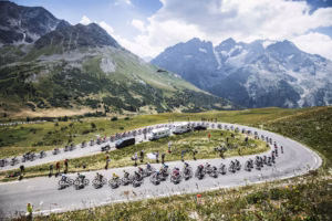
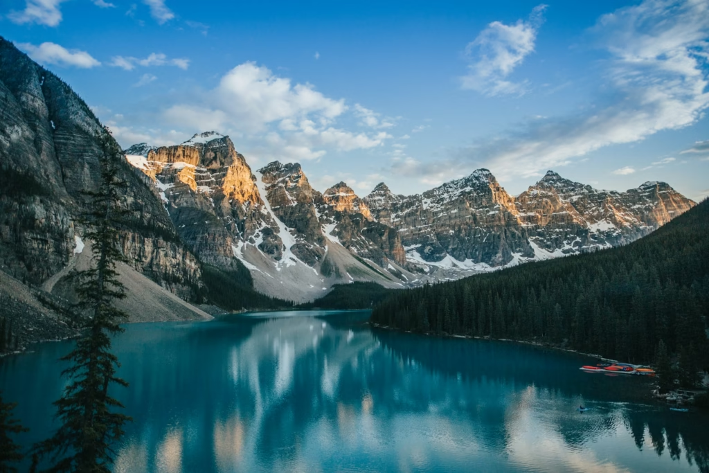
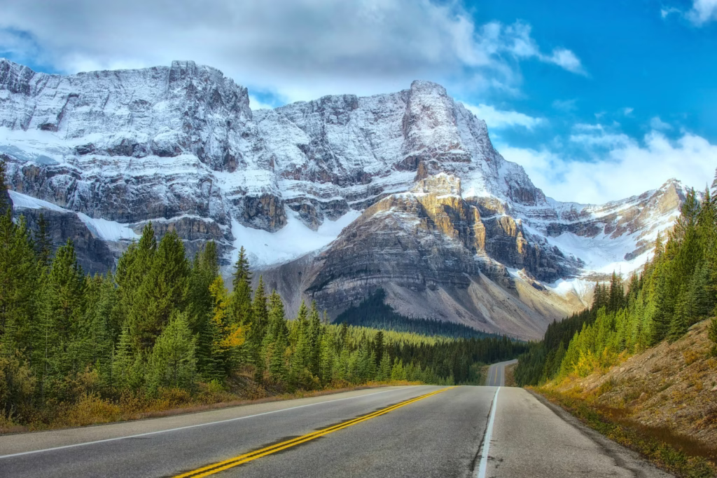
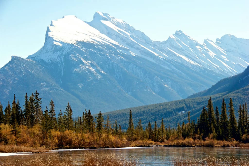
The Icefields Parkway, stretching 232 kilometres through the heart of the Canadian Rockies between Lake Louise and Jasper, stands as one of the world’s most spectacular cycling routes. This ribbon of asphalt, carved through glacial valleys and beneath towering peaks, offers cyclists an unparalleled journey through pristine wilderness, past turquoise lakes, and beneath more than 100 ancient glaciers. For those who view cycling not merely as sport but as a profound communion with the landscape, the Icefields Parkway represents the pinnacle of North American mountain cycling, a route that demands respect and rewards with memories that endure long after the journey ends.
Much like exploring cycling destinations across continents, the Canadian Rockies offer a travel-led cycling experience where the bike becomes the perfect vehicle for experiencing terrain at human speed, rich in detail and natural grandeur that simply cannot be appreciated from behind car windscreens.
The Route: Highway 93 North
The Icefields Parkway, officially designated as Highway 93 North (also known as AB-93), is not simply a road through mountains. It is a carefully planned corridor through two UNESCO World Heritage Sites, Banff National Park and Jasper National Park, conceived in the 1930s and completed in 1940 as both a Depression-era work project and a visionary tourism route.
Route Specifics:
- Total distance: 232 kilometres (144 miles) from Lake Louise to Jasper
- Direction: Most cyclists ride north (Lake Louise to Jasper) for prevailing tailwinds and gentler overall gradient
- Elevation profile: Starting elevation 1,540 metres (Lake Louise), high point 2,035 metres (Sunwapta Pass), ending elevation 1,060 metres (Jasper)
- Total elevation gain: Approximately 1,645 metres (5,400 feet) northbound
- Total elevation loss: Approximately 2,120 metres (6,955 feet) northbound
- Average completion time: 2-3 days for experienced touring cyclists, 3-5 days leisurely
- Difficulty level: Challenging, due to distance, elevation, remoteness, and weather variability
- Season: Late May through September (snow possible any month)
The sheer scale and setting are staggering. Designated by National Geographic as one of the world’s most scenic drives, the Parkway becomes transcendent when experienced by bicycle, where every gradient, every shift in temperature, and every wildlife encounter becomes immediate and visceral.
The Strategic Route Design and Gradient Profile
The northbound route (Lake Louise to Jasper) offers strategic advantages:
- Prevailing winds: Generally from southwest, providing tailwind assistance
- Net elevation loss: Overall descending 480 metres makes sustained climbing more manageable
- Major climbs front-loaded: Bow Summit (2,088m, highest point) comes early at kilometre 41 when legs are fresh
- Accommodation spacing: Better positioned for multi-day touring northbound
Key climbs and descents:
- Kilometres 0-41: Gradual climb from Lake Louise (1,540m) to Bow Summit (2,088m), including Bow Pass
- Kilometres 41-108: Rolling terrain through Saskatchewan River Crossing to Sunwapta Pass (2,035m)
- Kilometres 108-232: Overall descending toward Jasper (1,060m) via Athabasca Valley
Gateway Cities and Starting Points
Calgary: International Gateway
Most international cyclists arrive via Calgary International Airport (YYC), Alberta’s primary international hub located 128 kilometres east of Banff.
Calgary to Banff options:
- Rental car: Most flexible, 1.5 hours via Trans-Canada Highway 1
- Brewster Express shuttle: CAD $75 one-way, multiple daily departures
- On the Road Tours shuttle: Cyclist-friendly with bike transport
- Cycling route: 140 kilometres via Highway 1A (quiet alternative to Highway 1), moderate difficulty
Calgary itself offers limited compelling cycling, functioning primarily as logistical gateway rather than destination.
Canmore: Cyclist’s Preferred Base
Located 25 kilometres east of Banff, Canmore (elevation 1,310 metres) has emerged as the cyclist’s preferred base for Canadian Rockies exploration.
Why Canmore appeals to cyclists:
- Lower accommodation costs than Banff (CAD $150-250 vs CAD $250-450+ per night)
- Excellent bike shops and rental facilities
- Direct access to Legacy Trail (paved bike path to Banff)
- More relaxed, less touristy atmosphere
- Strong cycling community and café culture
Key Canmore cycling infrastructure:
- Legacy Trail: 26-kilometre paved, car-free path connecting Canmore to Banff
- Canmore Nordic Centre: World-class mountain bike trail network
- Bow Valley urban pathways: 70+ kilometres of paved multi-use paths
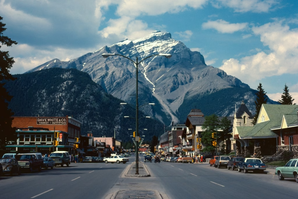
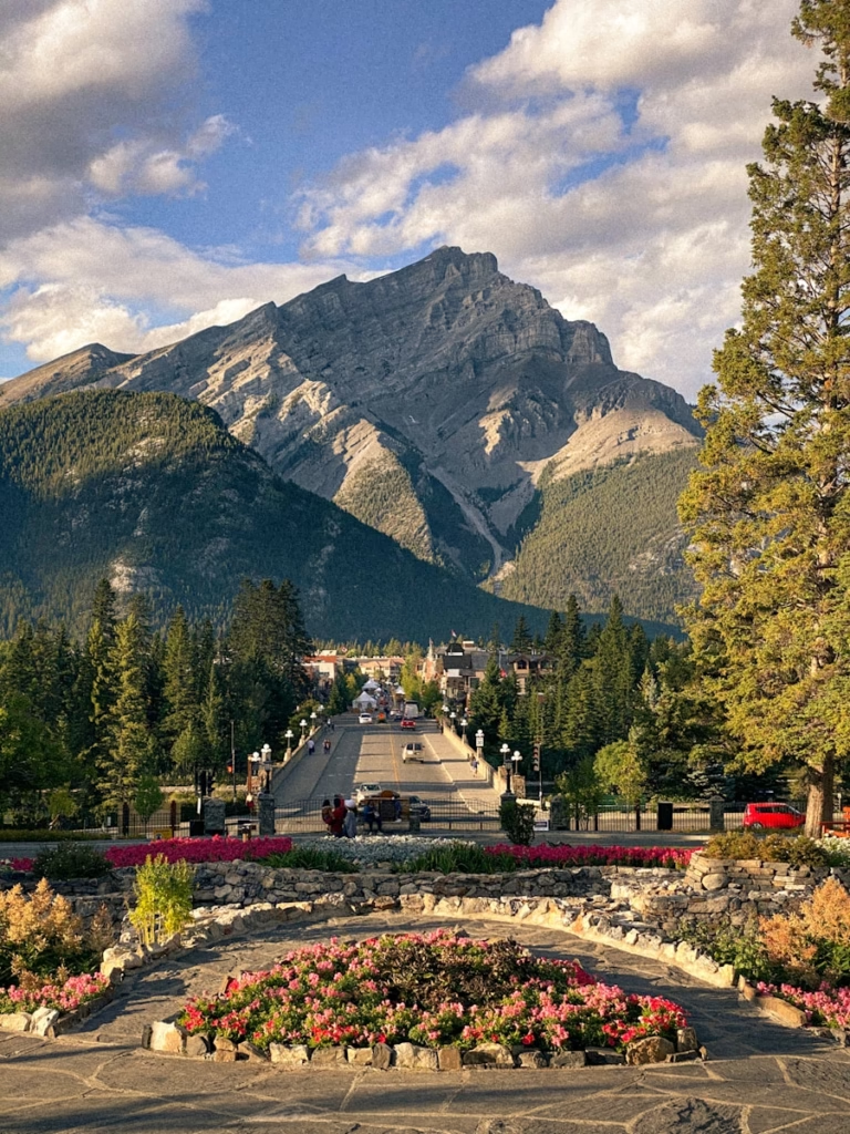
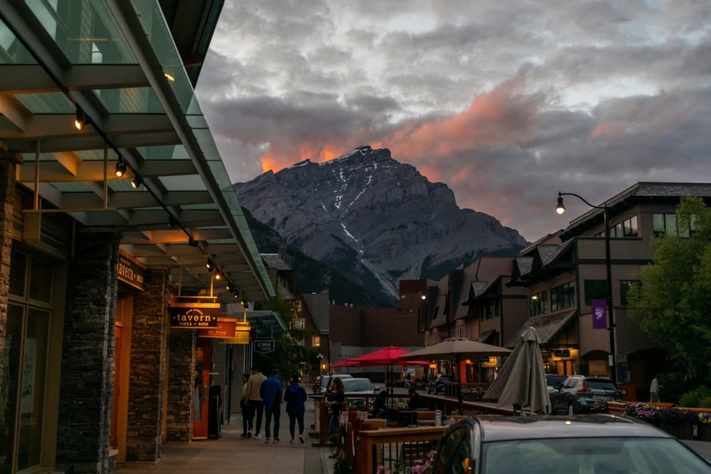
Banff: Gateway to the Icefields Parkway
Banff townsite (elevation 1,383 metres) serves as the southern gateway, positioned 58 kilometres from Lake Louise where the Icefields Parkway officially begins.
Banff cycling highlights:
- Bow Valley Parkway (Highway 1A): Vehicle-free May 1-June 25 and August 28-October 2 annually until 2029, offering 25 kilometres of stunning car-free riding
- Tunnel Mountain Road loop: Short climb with panoramic Bow Valley views
- Spray River Fire Road: Gravel route for mountain bikes
- Lake Minnewanka loop: 15-kilometre paved scenic ride
Banff to Lake Louise: 58 kilometres via Trans-Canada Highway 1 (busy, narrow shoulders) or Bow Valley Parkway/Highway 1A (quieter, more scenic, vehicle-free during summer periods).
Lake Louise: Icefields Parkway Starting Point
The tiny hamlet of Lake Louise (permanent population under 1,000) marks the official start of the Icefields Parkway at kilometre 0.
Essential facilities:
- Limited accommodation (book months ahead)
- Basic grocery store (expensive, limited selection)
- Parks Canada Visitor Centre
- Several cafés and restaurants
Most cyclists overnight in Lake Louise before departing early morning for the Parkway.
Jasper: Northern Terminus
Jasper townsite (elevation 1,060 metres, population 4,500) marks journey’s end, offering more relaxed atmosphere than Banff with excellent cyclist amenities.
Jasper advantages:
- Lower accommodation costs than Banff
- Excellent restaurants and breweries
- Well-developed cycling infrastructure
- Jasper National Park Visitor Centre
- Onward transport connections
The Icefields Parkway: Section by Section
Understanding the Parkway’s distinct sections aids in pacing, accommodation planning, and mental preparation.
Section 1: Lake Louise to Bow Summit (41km)
The opening section immediately establishes the route’s character, a steady climb through dense forest opening to spectacular alpine vistas.
Key features:
- Herbert Lake (3km): First photo stop, mirror-like glacial lake
- Hector Lake viewpoint (17km): Expansive valley views
- Crowfoot Glacier viewpoint (33km): First major glacier viewing
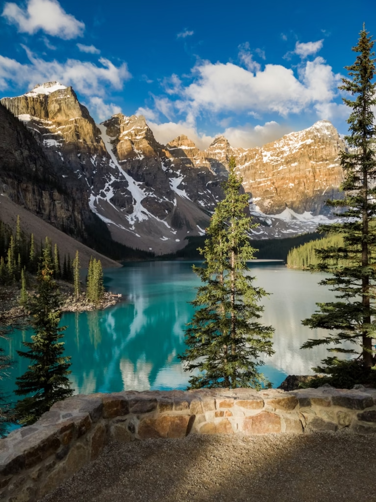
- Bow Lake and Num-Ti-Jah Lodge (37km): Stunning turquoise lake, food stop
- Bow Summit/Bow Pass (41km, 2,088m): Highest point on Parkway, Peyto Lake viewpoint (must-see)
Gradient: Steady 2-4% average climb, steeper sections 6-8% approaching Bow Pass
Accommodation: None between Lake Louise and Saskatchewan River Crossing (77km)
This section tests fitness immediately. The thin air above 2,000 metres affects even strong cyclists. The reward is Peyto Lake, whose otherworldly turquoise waters (caused by glacial rock flour) constitute one of Canada’s most photographed vistas.
Section 2: Bow Summit to Saskatchewan River Crossing (36km)
The route descends from Bow Summit before undulating through varied terrain toward the halfway point.
Key features:
- Peyto Lake viewpoint: 1.4km detour from highway (steep but essential)
- Mistaya Canyon (72km): Short hike to dramatic canyon
- Saskatchewan River Crossing (77km): Only services between Lake Louise and Sunwapta Falls
Gradient: Overall descending but several short climbs, rolling terrain
Facilities at Saskatchewan River Crossing:
- The Crossing Resort (restaurant, limited groceries, fuel)
- Only reliable food/water between Lake Louise and Columbia Icefields (77km span)
Section 3: Saskatchewan River Crossing to Columbia Icefield (47km)
The Parkway’s most remote and spectacular section, climbing to Sunwapta Pass with dramatic glacier views.
Key features:
- Weeping Wall (90km): Cliff face with waterfalls, often icy runoff across road
- Big Bend (99km): Series of steep switchbacks climbing toward Sunwapta Pass
- Sunwapta Pass (108km, 2,035m): Boundary between Banff and Jasper National Parks
- Columbia Icefield Discovery Centre (125km): Major tourist facility, glacier tours
Gradient: Sustained climbing from Saskatchewan River Crossing to Sunwapta Pass, 2-5% average with steeper Big Bend section at 6-8%
Critical considerations:
- Longest section between services (47km)
- Weather highly variable, snow possible any month
- Big Bend switchbacks challenging, traffic heavy with tour buses
- Columbia Icefield Discovery Centre offers meals, snacks, water (expensive but essential)
This section epitomises the Parkway’s grandeur. The Athabasca Glacier (visible from highway) and surrounding icefields create primordial landscape, humbling in scale.
Section 4: Columbia Icefield to Sunwapta Falls (60km)
Steady descent through Athabasca Valley with frequent glacier and wildlife viewing opportunities.
Key features:
- Athabasca Falls (155km): Powerful waterfall, short detour, worth visiting
- Sunwapta Falls Rocky Mountain Lodge (180km): Accommodation and dining
Gradient: Overall descending 3-4%, allowing recovery after climbs
Wildlife: Prime grizzly bear and elk habitat, vigilance essential
Section 5: Sunwapta Falls to Jasper (52km)
The final stretch descends gently into Jasper, with spectacular mountain vistas throughout.
Key features:
- Athabasca River valley views: Consistent throughout
- Final descent into Jasper: Gradual, triumphant entry
Gradient: Gentle descending 2-3%, celebratory finish
Essential Preparation and Logistics
As with any serious endurance cycling challenge, the Icefields Parkway demands meticulous preparation extending beyond standard touring equipment.
Bicycle Choice and Gearing Recommendations
The Parkway’s sustained climbs, variable weather, and remoteness require appropriate bicycle and gearing choices.
Recommended bicycle types:
- Touring bikes: Steel or aluminium frames with rack mounts, wide tyre clearance
- Gravel bikes: Modern alternative, comfortable geometry, versatile
- Lightweight touring bikes: Carbon or titanium for those prioritising weight
- E-bikes: Increasingly popular, extending access to less fit riders
Critical gearing specifications:
- Compact or sub-compact chainrings: 50/34 or 48/32 essential
- Wide-range cassette: 11-34 minimum, 11-36 or 11-40 recommended for loaded touring
- Low gear ratio: Ability to spin 1:1 or lower gear ratios crucial for sustained climbs at altitude
Not recommended:
- Racing bikes with standard gearing
- Bikes without pannier mounts (unless using bikepacking bags)
Bike Rental Options
For those travelling without bikes, quality rental options exist, though advance booking is essential.
Banff and Canmore Rental Shops
- Premium bike rental specialist in downtown Banff
- E-bikes, hybrid, mountain, and high-performance road bikes
- Rates: CAD $60-120/day depending on specification
- Multi-day discounts: 20% off after 2 days
- Delivery and pickup services available
- Expert staff with Icefields Parkway experience
- Locations in both Canmore and Banff
- E-bikes, road bikes, hybrids, mountain bikes
- Rates: CAD $50-110/day
- One-way rentals possible between locations
- Giant hybrid and e-bikes
- Specialise in Legacy Trail rentals
- Rates: CAD $45-95/day
- 48-hour advance reservation required
Jasper Rental Options
Jasper Source for Sports
- Full-service bike shop
- Road, hybrid, and mountain bike rentals
- Rates: CAD $50-90/day
- Limited fleet, advance booking essential
Note: One-way bike rental (Lake Louise to Jasper or reverse) generally unavailable. Most cyclists either:
- Return same route (doubling distance)
- Arrange shuttle service for bike return
- Use tour company providing bikes
Guided Tour Companies
For a comprehensive supported experience, several companies specialise in Icefields Parkway cycling tours.
- Jasper to Banff tours (reverse direction)
- 6-day fully supported tours
- Includes accommodation, meals, luggage transport, mechanical support
- High-quality rental bikes available (road and e-bikes)
- Rates: CAD $2,800-3,500 per person
Fresh Tracks Canada
- 5-7 day Icefields Parkway tours
- Fully supported with vehicle support
- Premium accommodation options
- Rates: CAD $3,200-4,200 per person
Advantages of guided tours:
- Luggage transport between accommodations
- Mechanical support and spare bikes
- Local knowledge and wildlife safety
- Guaranteed accommodation in peak season
- Meals included
- No logistical stress
Navigation and Route Following
Navigation on the Icefields Parkway is remarkably straightforward.
Route characteristics:
- Single highway (no junctions or turns)
- Clear kilometre markers every kilometre
- Parks Canada highway signs indicating distances to major points
- Cell phone coverage sporadic (reliable near Lake Louise, Jasper, intermittent elsewhere)
Recommended navigation:
- GPS device with route loaded (Garmin, Wahoo)
- Offline maps on smartphone
- Paper map as backup (available at Parks Canada visitor centres)
Accommodation Planning
Accommodation along the Icefields Parkway is extremely limited, requiring advance planning.
Lake Louise Accommodation
- Iconic luxury hotel on Lake Louise shores
- Rates: CAD $500-1,200+ per night
- Book 6+ months in advance for summer
- Cyclist amenities: secure bike storage, early breakfast
Lake Louise Inn
- More affordable option
- Rates: CAD $250-400 per night
- Restaurant and basic amenities
HI Lake Louise Alpine Centre
- Hostel option
- Rates: CAD $50-90 per bed (dorms) or CAD $180-250 (private rooms)
- Popular with cyclists, book early
On-Parkway Accommodation (Limited)
Num-Ti-Jah Lodge (37km from Lake Louise)
- Historic lodge at Bow Lake
- Rates: CAD $250-400 per night
- No electricity, generator power only
- Restaurant serves breakfast, lunch, dinner
- Book 3-6 months advance
Saskatchewan River Crossing (77km)
- The Crossing Resort
- Rates: CAD $200-300 per night
- Basic motel-style rooms
- Restaurant and small grocery
- Strategic halfway point
- Limited rooms, book well in advance
Sunwapta Falls Rocky Mountain Lodge (180km)
- Rates: CAD $250-350 per night
- Restaurant and bar
- Well-positioned for splitting journey into three days
- Book 2-3 months advance
Jasper Accommodation
- Luxury lakeside resort, cedar cabins and hotel rooms
- Rates: CAD $400-900+ per night
- Golf course, multiple restaurants, spa
- Cyclist amenities: bike storage, gear cleaning areas
Crimson Jasper
- Modern hotel, excellent value
- Rates: CAD $200-350 per night
- Kitchen facilities, pool, hot tub
Tekarra Lodge
- Log cabin accommodation
- Rates: CAD $250-400 per night
- Peaceful, rustic setting
Whistlers Inn
- Budget-friendly option
- Rates: CAD $150-250 per night
- Basic amenities, convenient location
HI Jasper Hostel
- Budget accommodation
- Rates: CAD $45-80 per bed (dorms) or CAD $150-200 (private rooms)
Camping Options
Parks Canada operates campgrounds along the route, offering budget alternative.
Major campgrounds (north to south):
- Wilcox Creek (4km south of Columbia Icefield) – Primitive
- Rampart Creek (31km north of Saskatchewan River Crossing) – Primitive
- Mosquito Creek (24km north of Lake Louise) – Primitive
- Waterfowl Lakes (30km north of Saskatchewan River Crossing) – Developed
- Honeymoon Lake (52km south of Jasper) – Primitive
Camping considerations:
- Rates: CAD $18-28 per site
- Facilities range from primitive (pit toilets, no water) to developed (flush toilets, taps)
- Bear-proof food storage mandatory
- Advance reservations possible for some campgrounds via Parks Canada website
- First-come, first-served at primitive sites (risky in peak season)
Nutrition, Hydration, and Resupply
The Parkway’s remoteness demands careful nutrition and hydration planning.
Water sources:
- Natural streams are abundant (filter or purify essential)
- Parks Canada campgrounds have potable water
- Num-Ti-Jah Lodge, Saskatchewan River Crossing, Columbia Icefield Discovery Centre, Sunwapta Falls Lodge
- Carry minimum 3 litres capacity
Food resupply:
- Lake Louise: Small grocery (limited, expensive)
- Saskatchewan River Crossing: Very limited grocery items
- Columbia Icefield Discovery Centre: Cafeteria (expensive)
- Jasper: Full grocery stores
Daily nutrition strategy:
- 60-90g carbohydrates per hour during riding
- High-calorie snacks (nuts, bars, dried fruit)
- Budget CAD $40-60 per day for food if not camping
- Restaurant meals at lodges CAD $20-35 for breakfast, CAD $35-60 for dinner
Where to shop before departing:
- Canmore: Safeway, Save-On-Foods, Mountain Mercato
- Banff: Nesters Market, Nutter’s Bulk & Natural Foods
- Jasper: Nesters Market, IGA
Safety and Wildlife Considerations
The Icefields Parkway traverses prime grizzly bear, black bear, elk, moose, and bighorn sheep habitat.
Critical safety protocols:
- Bear spray mandatory: Carry on person (not in a pannier), know how to use
- Make noise: Bears avoid humans if given warning
- Store food properly: Use bear-proof containers or hang food at campgrounds
- Never approach wildlife: Minimum 30 metres for elk/deer, 100 metres for bears
- Travel in groups: Safer than solo cycling in bear country
Bear spray rental: Most bike shops and outdoor stores rent bear spray (CAD $40-50 for multi-day rental vs CAD $60-70 to purchase).
Wildlife encounter protocol:
- Remain calm, don’t run
- Back away slowly while facing animal
- If bear charges, use bear spray when within 5-10 metres
- Make yourself large, speak firmly
Road safety:
- Narrow or non-existent shoulders on many sections
- RVs and tour buses create wind blast, traffic heavy June-August
- Ride defensively, use rear-view mirror
- High-visibility clothing essential
- Front and rear lights recommended even in daytime
Weather hazards:
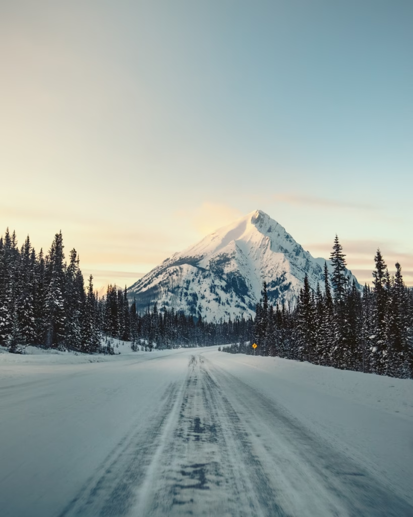
- Snow possible any month (August snow not uncommon)
- Afternoon thunderstorms common July-August
- Temperature swings 20°C+ from morning to afternoon
- Hypothermia risk real, especially if wet
When to Visit: Optimising Your Experience
The Parkway’s extreme climate creates a narrow seasonal window for safe cycling.
Late May – Mid-June: Shoulder Season
Temperatures:
- Valley bottom: 5-18°C
- High passes: -2-10°C
- Snow still present at higher elevations
Advantages:
- Fewer tourists, lighter traffic
- Lower accommodation rates
- Stunning snow-capped peaks
- Wildlife more active (bear breeding season)
Challenges:
- Services reduced (some facilities closed)
- Weather highly unpredictable
- Hypothermia risk higher
- Some campgrounds still closed
- Avalanche debris occasionally on the road
July – August: Peak Season
Temperatures:
- Valley bottom: 12-25°C
- High passes: 5-15°C
- Warmest, most stable conditions
Advantages:
- All services operating
- Longest daylight hours (5:30am-10pm)
- Most stable weather
- Warmest temperatures
Challenges:
- Heavy traffic (RVs, tour buses, motorcycles)
- Accommodation expensive and scarce
- Tourist congestion at viewpoints
- Afternoon thunderstorms frequent
- Wildfire smoke possible (increasingly common)
September – Early October: Autumn Window
Temperatures:
- Valley bottom: 2-15°C
- High passes: -5-8°C
- Rapidly cooling
Advantages:
- Stunning autumn colours (larches turn golden)
- Dramatically reduced traffic post-Labour Day
- Wildlife active (elk rutting season)
- Crisp, clear conditions
Challenges:
- Services reducing (some facilities close mid-September)
- Snow increasingly likely at passes
- Shorter daylight hours
- Hypothermia risk increasing
- Some campgrounds closed
Optimal window: Mid-June through mid-September, with July-August offering the most reliable conditions but the heaviest traffic.
Training and Fitness Preparation
The Icefields Parkway’s combination of distance, elevation, altitude, and remoteness demands appropriate fitness preparation.
Recommended baseline fitness:
- Ability to ride 80-120 kilometres per day for consecutive days
- Comfortable climbing 800-1,200 metres elevation gain daily
- Experience with loaded touring (15-20kg of gear)
- Previous multi-day tour experience helpful
Training recommendations (12-16 week programme):
- Build to back-to-back 100+km days with 800m+ climbing
- Practice climbing with loaded bike
- Simulate altitude (if possible) or expect reduced performance
- Test all equipment on extended rides
- Practice self-sufficiency (basic repairs, navigation)
Pacing strategy:
- First day (Lake Louise to Saskatchewan River Crossing): 77km, conversational pace
- Expect 15-20% reduced power output at 2,000m+ altitude
- Stay in Zone 2-3 for sustained climbs
- Allow extra time for photo stops, wildlife viewing
Comparing the Icefields Parkway to Other Routes
The Icefields Parkway occupies unique space amongst world-class cycling routes.
vs. European Alpine routes:
- Longer sustained distance than single Alpine passes
- Less severe gradients than European giants (2-5% vs 8-12%+)
- More remote, less infrastructure
- Comparable altitude (2,088m vs 2,000-2,700m for major Alpine passes)
- Superior wildlife viewing
- Less traffic on early-season or September rides
vs. US mountain routes:
- Similar to Going-to-the-Sun Road (Montana) but longer
- More accessible than Colorado high passes (lower altitude)
- Better road surface than many California mountain roads
- More reliable services than many remote US routes
vs. Other Canadian routes:
- Most iconic cycling route in Canada
- More challenging than Vancouver-Calgary routes
- Better infrastructure than northern Canadian routes
- Comparable to Cabot Trail (Nova Scotia) for scenery but more mountainous
For cyclists exploring North American cycling destinations, the Icefields Parkway represents the continent’s premier mountain cycling experience.
Conclusion: The Icefields Parkway Experience
The Icefields Parkway transcends typical cycling routes. It is a carefully preserved corridor through a wilderness of such scale and grandeur that humans necessarily shrink to appropriate insignificance. The journey offers not just miles covered but a profound connection with the landscape, where every pedal stroke carries you deeper into the mountain fastness unchanged for millennia.
This is cycling demanding respect for the environment, preparation for challenges, and openness to transformation. Whether you’re an experienced touring cyclist seeking world-class mountain scenery, a wildlife enthusiast craving close encounters with grizzlies and elk, or a passionate rider simply craving escape into pristine wilderness, the Icefields Parkway delivers an unforgettable experience.
The combination of engineering achievement (a highway through seemingly impassable terrain), ecological significance (protecting critical wildlife corridors), and sheer visual magnificence creates a multi-dimensional experience unlike any other cycling route worldwide. The question isn’t whether the Parkway will challenge you, but how you’ll emerge from three days pedalling through one of Earth’s last great wildernesses.
For more inspiration for exploring cycling destinations beyond traditional circuits, visit our guide to cycling around the world.
Frequently Asked Questions
What is the best time of year to cycle the Icefields Parkway?
The optimal period is July through mid-September, offering the warmest temperatures (12-25°C valleys, 5-15°C passes), most reliable weather, and all services operating. However, this coincides with peak tourism, meaning heavy traffic. For fewer tourists whilst accepting weather uncertainty, late June or September offer excellent alternatives with stunning scenery (wildflowers in June, autumn colours in September) and dramatically reduced traffic. Snow is possible any month at high passes, particularly Bow Summit and Sunwapta Pass. Avoid May and October unless experienced in cold-weather touring, as services are limited and hypothermia risk is significant.
How difficult is cycling the Icefields Parkway compared to other mountain routes?
The Icefields Parkway is genuinely challenging and best suited for experienced touring cyclists. The 232-kilometre distance combined with 1,645 metres of elevation gain (northbound), altitude effects above 2,000 metres, weather variability, and remoteness create a formidable undertaking. Gradients are moderate (2-5% average, 6-8% steeper sections) compared to European Alpine climbs, but the sustained nature and thin air make it demanding. Critical requirements include: ability to ride 80-120km daily for consecutive days, experience with loaded touring, self-sufficiency for basic repairs, and appropriate gearing (compact chainrings with 11-34+ cassette minimum). The remoteness and wildlife (grizzly bear country) add complexity absent from most European routes.
Can I rent a bicycle specifically for the Icefields Parkway?
Yes, several high-quality rental companies in Banff and Canmore provide appropriate bikes for the Parkway. Banff Cycle & Sport offers premium touring bikes, e-bikes, and high-performance road bikes (CAD $60-120/day) with multi-day discounts. Château Mountain Sports has locations in both Canmore and Banff (CAD $50-110/day). GearUp Sports in Canmore specialises in Giant bikes (CAD $45-95/day). All shops understand the Parkway’s demands and provide appropriate gearing. However, one-way rentals (Lake Louise to Jasper) are generally unavailable, requiring either a return ride or a shuttle arrangement. Advance booking is essential, especially June-September. Guided tour companies like Mountain Madness Cycle Tours include high-quality rental bikes in package prices.
Where can I stay along the Icefields Parkway?
Accommodation is extremely limited, requiring advance planning. On the Parkway itself, only three options exist: Num-Ti-Jah Lodge at Bow Lake (37km, CAD $250-400, book 3-6 months ahead), Saskatchewan River Crossing (77km, CAD $200-300, book early), and Sunwapta Falls Lodge (180km, CAD $250-350). Most cyclists start at Lake Louise (Fairmont Château CAD $500-1,200, hostel CAD $50-90) and finish in Jasper (Fairmont Jasper Park Lodge CAD $400-900, or budget options CAD $150-350). Parks Canada campgrounds offer budget alternative (CAD $18-28 per site), but facilities range from primitive to basic. The strategic halfway point is Saskatchewan River Crossing, allowing 77km first day, 103km second day, 52km final day into Jasper.
What are the main safety concerns when cycling the Icefields Parkway?
Primary safety concerns include: (1) Wildlife, particularly grizzly bears and black bears, requiring mandatory bear spray, proper food storage, and awareness protocols, (2) Weather variability, with snow possible any month, rapid temperature swings, and hypothermia risk especially if wet, (3) Remoteness, with limited cell coverage, long distances between services (77km Lake Louise to Saskatchewan River Crossing), and self-sufficiency requirements for basic repairs, (4) Traffic, including large RVs and tour buses creating wind blast on narrow shoulders, demanding defensive riding and high-visibility clothing, (5) Altitude effects above 2,000 metres, reducing performance and potentially causing altitude sickness. Essential safety equipment includes bear spray, a comprehensive repair kit, an emergency shelter/bivvy, a first-aid kit, water filtration, and a satellite communicator (InReach/SPOT) for true emergencies.