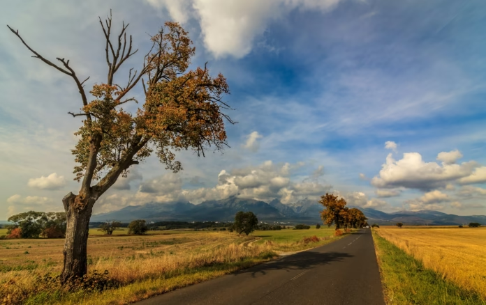
Zakopane sits at the foot of Poland’s Tatra Mountains, with a mix of steep village roads, woodland lanes and ridgelines overlooking some of Central Europe’s most distinctive peaks. It is a rewarding base for cyclists who want a few days of hard climbing without travelling to the Alps. The town itself is lively and heavily visited, but rides through Kościelisko, Witów, Ząb and Gliczarów can lead quickly into a much quieter landscape.
There is one essential difference from a conventional Alpine road-cycling destination: much of the spectacular high mountain area is protected within Tatra National Park. Bicycles are permitted on selected routes, not on every path or apparently rideable mountain road. Some of the published local cycle loops use gravel, stone and forest tracks, making them better suited to gravel bikes or mountain bikes than narrow-tyred road machines. The most satisfying visit begins by matching each route to the right bicycle.
Zakopane also offers more than climbs. Traditional timber architecture, Highland food, panoramic views and access to walking trails mean a rest day is useful rather than an inconvenience. A good trip might combine two demanding road rides, a mixed-surface day along the authorised Chochołowska Valley route and an excursion into Slovakia to see another side of the mountain range.
What are the climbs around Zakopane like?
The roads around Zakopane climb repeatedly from valley villages to high ridges. They are not necessarily long mountain passes of twenty or thirty kilometres, but the gradients can be sharp and an apparently modest ride can include repeated steep efforts. The climbs often pass houses and fields before opening into views across the Tatra range. Descents can be narrow and busy with cars, so confidence on the way down matters as much as strength uphill.
The Gubałówka ridge rises above Zakopane to around 1,123 metres. It is one of the area’s best-known viewpoints, and several local cycle routes approach the ridge from different directions. The most useful for visiting cyclists are the roads linking nearby villages, rather than trying to find the shortest way up from a congested town centre.
A ride towards Gliczarów Górny is another test. The road from Biały Dunajec to the higher village includes a steep asphalt ascent that makes it attractive to riders wanting a concentrated climbing effort. The official tourism loop continues towards Bukowina Tatrzańska and uses gravel on the return. Road cyclists should therefore select a mapped asphalt alternative instead of assuming the published twenty-kilometre tourist circuit is entirely sealed.
Local distance figures should be interpreted with care. Zakopane’s official descriptions sometimes quote ‘height difference’ of about 300 metres, which is not the same as accumulated ascent measured by a GPS computer. On a rolling route a rider might climb much more in total than the difference between its lowest and highest points. Check the actual profile before deciding whether a ride is suitable for a recovery day.
Three useful cycling routes and their surfaces
Zakopane, Witów, Dzianisz and Gubałówka: The town’s tourism service describes a difficult loop of roughly 30 kilometres, taking about three and a half hours at its suggested sightseeing pace. Starting from Polana Szymoszkowa, the route heads through Kościelisko, uses a gravel forest road towards Płazówka, continues to Witów and climbs through Dzianisz towards the Gubałówka ridge. The views are excellent, but the gravel link means this should not be promoted as a pure road-cycling loop without a tarmac diversion.
Harenda, Ząb, Bachledówka and Gubałówka: This official circuit is approximately 35 kilometres, with repeated climbs linking the villages above town. It passes Ząb, Furmanowa, Gubałówka and the Bachledówka area, offering wide views of the Tatras and the neighbouring Podhale region. A rider who enjoys repeated steep ramps and village scenery may prefer it to a long mountain-pass route. The tourism authority classifies it as difficult and allows around four hours at a visitor’s pace.
Biały Dunajec, Gliczarów Górny and Bukowina Tatrzańska: The official 20-kilometre loop climbs on asphalt towards Gliczarów Górny and then takes smaller roads towards Bukowina. The return includes gravel and a field track, which changes its suitability. Cyclists seeking a road-only ride can use the climb as the central feature of a differently planned tarmac circuit, checking current traffic and surface conditions before departing.
A gravel bike with robust tyres creates the most flexible options because it can manage the unsealed parts of these routes without sacrificing too much speed on tarmac. A road bike remains a good choice for the recognised paved climbs, provided the rider is willing to use a different return where a tourist route leaves the road. Mountain bikes are better suited to the rockier authorised trails and any planned off-road exploration.
Can you cycle inside Tatra National Park?
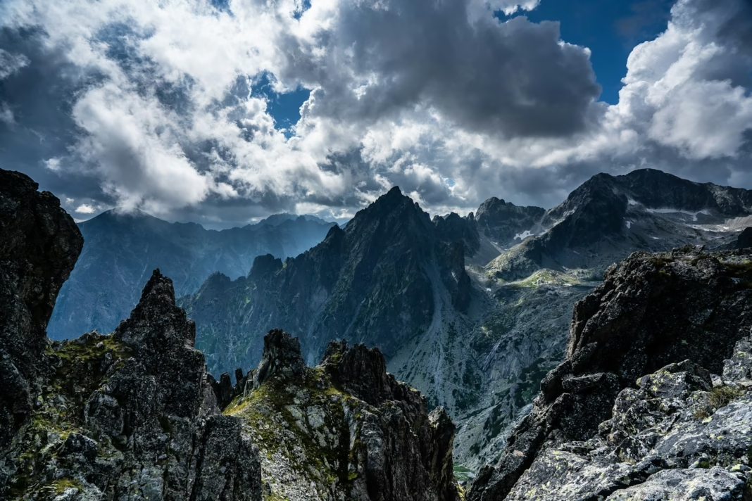
Yes, but only on designated cycling routes. This is one of the most important practical rules for visitors. A walking path inside the Polish national park is not automatically open to bicycles, even when the surface looks smooth or a GPS app displays another person’s recorded ride. The restrictions protect sensitive mountain habitats and help separate faster riders from crowded pedestrian routes.
The Chochołowska Valley is a recognised cycling option. Riders can begin at Siwa Polana and follow the designated valley route, which initially uses asphalt before becoming much rougher and stonier. The route reaches attractive mountain scenery and can be completed as an out-and-back or incorporated into a larger mixed-surface day. The presence of walkers calls for a relaxed pace and careful passing rather than using the valley as a time-trial course.
Zakopane’s official tourism service describes a Kościelisko to Dolina Chochołowska circuit of roughly 25 kilometres, with a mixture of asphalt, gravel and rocky track. It is marked as a difficult ride and takes approximately three hours at a sightseeing pace. That figure applies to the described route, not to a departure from any hotel in central Zakopane. It is worth planning the extra distance to and from the start.
Morskie Oko is another famous destination, but cyclists should not ride the approach road as though it were an unrestricted pass. Under the normal national park rules, bicycles are not permitted on the road towards Morskie Oko. Despite the apparently inviting tarmac, this is a walking and authorised transport route rather than a recommended cycling climb. A visit to the lake is best planned separately on foot.
Park access rules, admission charges and temporary closures can change. Visitors should check the current information from Tatra National Park before taking a bicycle inside its boundary and not rely entirely on third-party route websites. Good route planning here is partly an environmental responsibility.
Crossing into Slovakia and the High Tatra roads
The mountains do not stop at the national border, and the Slovak side offers useful riding for anyone spending several days in the region. The Cesta Slobody, or Road of Freedom, links resort communities along the southern side of the High Tatras. Paved stretches provide expansive mountain views and a different style of ride from the narrow climbs immediately around Zakopane.
Touring routes use the corridor between Liptovský Hrádok and Kežmarok via places such as Štrbské Pleso and Starý Smokovec. A typical broad traverse is around 68 kilometres, though the exact distance depends on the chosen endpoints and connections. Those road sections can suit an experienced road cyclist, but traffic, weather and any local restrictions should be checked just as carefully as in Poland.
From Poprad, a climb towards Starý Smokovec is another accessible idea, rising from the lower town towards the mountain resort over roughly 14 to 15 kilometres depending on the route. That makes it a more sustained effort than some of the short village climbs around Zakopane. The attraction is steady elevation gain and views rather than a famous professional race finish.
A Slovak excursion is not automatically a short day trip from central Zakopane. The roads between the two sides can create a long journey, and some mountain crossings require careful planning. Consider using transport to start a loop from the Slovak side, or split accommodation between Poland and Slovakia, especially if travelling with a companion who wants time for sightseeing.
When to go, traffic and weather
Late spring to early autumn is generally the most practical period for a cycling holiday, with June and September often offering a useful balance of daylight and lower visitor pressure. The mountains can still be cold and wet even when the town feels warm, so each ride should be chosen against a current forecast. Snow can remain on high ground in spring, and colder conditions may return early in autumn.
Heavy summer tourism makes some roads around central Zakopane busy, especially at weekends. The main routes into town carry buses, delivery vehicles and large volumes of cars. Quiet hours and village back roads are usually more pleasant than attempting a long ride on the busiest approach. Start early where possible, but use lights and visible clothing if the morning begins under low cloud or rain.
Rain can make steep descents slippery and turns awkward. A dry asphalt lane may have gravel washed onto it after a storm, while a forest track may develop ruts that are difficult on narrow tyres. Carry a jacket, warm layer and basic repairs, and consider gearing that allows relaxed climbing on the steeper village ramps. The energy saved by a lower gear may matter more than the difference between an aggressive racing position and a comfortable endurance setup.
Riders should also allow enough time for descents. A climb completed quickly can lead into a much slower descent if roads are narrow, wet or shared with pedestrians near a viewpoint. It is not a destination where averaging a high speed necessarily means having the best ride. The mountain setting rewards a more considered pace and frequent stops.
For a comparison with a very different highland cycling destination, ProCyclingUK’s guide to cycling in and around Bogotá explores how altitude, terrain and urban access shape route planning. In Zakopane the principal constraint is often the national park boundary, which makes choosing the right legal road or trail more important than simply heading towards the highest point on the map.
Where to stay and how to build a trip
Most international visitors arrive through Kraków, then travel south to Zakopane by train, coach or car. Journey times depend on traffic and the service, and bicycle-carriage rules should be checked before booking. If using public transport, make sure the bike has a reserved place where required and that any transfer can be completed with luggage. Accommodation with secure bike storage is more useful than a hotel with a slightly more central address but nowhere safe to keep equipment.
Central Zakopane is convenient for food, shops and evenings off the bike, but Kościelisko west of town offers an easier start for routes through Witów and Dzianisz. Staying around Biały Dunajec or Bukowina Tatrzańska can be attractive to riders targeting local asphalt climbs. A split stay with the Slovak side is worth considering for a longer week.
A practical three-day riding programme could start with a tarmac circuit around Kościelisko, followed by a harder day using the Gliczarów Górny climb and a verified asphalt return. The third day might be a mixed-surface trip into the permitted Chochołowska Valley, using a gravel bike or hired mountain bike. A separate rest day allows time to walk to some of the viewpoints that bicycles cannot legally reach.
This part of Poland is attractive precisely because it combines cycling with a distinctive local culture and landscape. The traditional wooden architecture, food and views across the Tatras remain interesting even when bad weather shortens a day on the bike. The strongest itinerary is one that respects the park rules, matches surfaces to equipment and leaves room to explore beyond the headline climbs.