The Victorian High Country, with the alpine town of Bright at its heart, stands as Australia’s premier mountain cycling destination. Here, where the Ovens River carves through valleys beneath the Great Dividing Range, lies a concentration of challenging climbs that have tested the nation’s finest riders since the 1940s. Within striking distance of this charming mountain town, you can tackle Falls Creek, Mount Hotham (Australia’s highest paved road), Mount Buffalo, and the Tawonga Gap, names that echo through Australian cycling history with the same reverence Europeans reserve for their Alpine giants. For those who view climbing not merely as a physical challenge but as communion with the landscape, the High Country offers an unparalleled journey through eucalypt forests, alpine meadows, and mountain vistas that define the Australian alpine experience.
Much like exploring iconic cycling destinations worldwide, Victoria’s High Country rewards those willing to embrace sustained climbing through landscapes utterly distinct from European mountains, where the scent of eucalyptus replaces pine, and crimson rosellas replace alpine choughs.

The Victorian High Country: Geography and Character
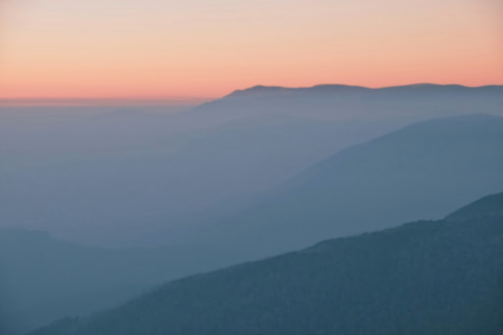
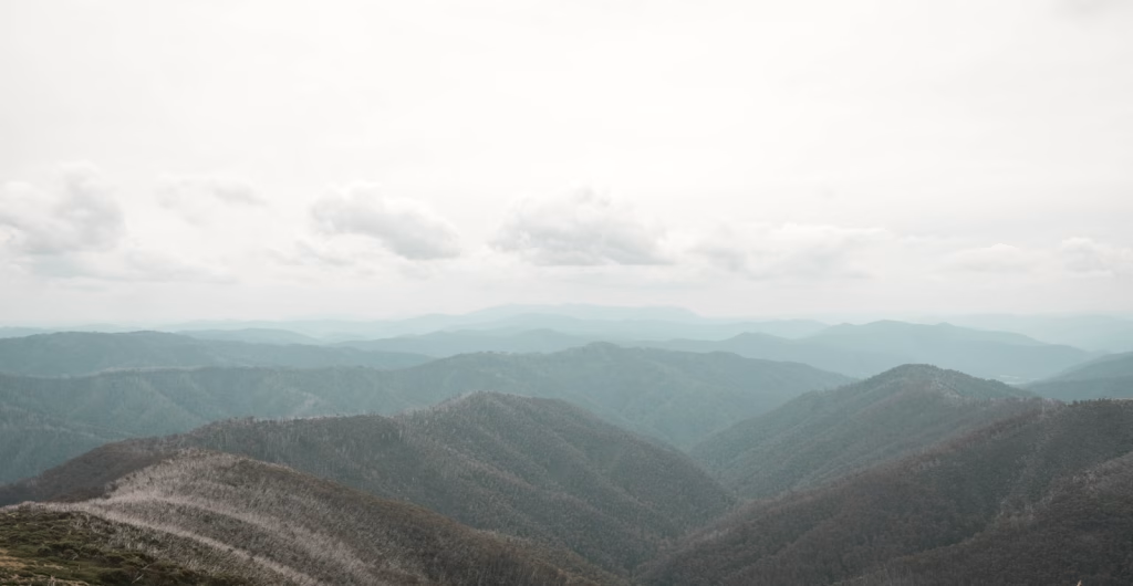
The Victorian Alps form the southern terminus of Australia’s Great Dividing Range, a region where mountains rise dramatically from their foothill valleys to elevations approaching 2,000 metres. Unlike the European Alps with their glaciated spires and permanent snowfields, the High Country presents a gentler, more ancient landscape carved by millions of years of erosion rather than ice. The mountains roll rather than spike, covered in dense eucalypt forest transitioning to snow gum woodland and finally alpine herb fields above treeline.
The region’s character reflects its dual nature. In summer (December through March), the High Country becomes a haven for cycling, with wildflowers carpeting alpine meadows and daytime temperatures reaching 20-25°C in valleys whilst summits cool to 10-15°C. In winter (June through September), these same roads disappear beneath heavy snowfall, transforming into ski fields that support Victoria’s alpine resort economy. This seasonal transformation shapes the cycling experience, concentrating riding into a distinct window when roads are clear and the weather is cooperative.
The geology differs markedly from that of younger mountain ranges. The Victorian Alps consist primarily of granite and sedimentary rock, creating a distinctive character where massive granite boulders punctuate ridgelines, and weathering has sculpted rounded rather than jagged peaks. The vegetation tells the story of adaptation to harsh conditions, with snow gums contorting into twisted forms above 1,600 metres, their white bark gleaming against blue sky.
Bright: The High Country’s Cycling Capital
Positioned at 319 metres of elevation, where the Ovens River meets mountain tributaries, Bright (population 2,500, swelling to 8,000+ in peak season) functions as the strategic base for High Country cycling. The town’s position offers unparalleled access to the region’s greatest climbs whilst maintaining valley comfort and full-service amenities that have evolved specifically around cycling tourism.
Why Bright?
The town occupies a perfect geographical position at the convergence of multiple valley systems. Falls Creek lies 32 kilometres distant via the Bogong High Plains Road, Mount Hotham 65 kilometres through spectacular alpine scenery, Mount Buffalo 30 kilometres up the formidable Buffalo Gorge, and Tawonga Gap merely 20 kilometres away on quieter back roads. Beyond these headline climbs, dozens of smaller ascents radiate from town, offering everything from gentle warm-up rides to challenging gradient tests.
Bright’s cycling infrastructure has matured over the decades. The Murray to Mountains Rail Trail, a 100-kilometre paved path connecting Bright to Wangaratta, Beechworth, and surrounding towns, provides car-free riding through farmland and forest. The town centre features multiple bike shops offering high-quality rentals, expert mechanical support, and local knowledge accumulated over generations. Cafés along Gavan Street understand cyclists’ needs, opening early for pre-ride breakfast and tolerating lycra-clad groups discussing gradient percentages over long blacks.
The town maintains an authentic alpine character without resort artificiality. Established during the 1850s gold rush, Bright retains Victorian-era buildings lining tree-shaded streets. Autumn (March through May) transforms the town into a brilliant display when introduced European trees, planted by homesick miners, ignite in reds, golds, and oranges that rival New England’s famous fall colours. The Bright Autumn Festival in late April celebrates this transformation, though cyclists generally prefer the quieter weeks before or after the crowds descend.
The Valley System and Approach Routes
Understanding the valley structure clarifies route planning. Bright sits at the junction where the Ovens River meets smaller tributaries draining from surrounding ranges. The primary valleys radiating from town include the Ovens Valley running northeast toward Myrtleford and northwest toward Harrietville, the Buffalo River valley heading south toward Mount Buffalo, and the Kiewa Valley branching east toward Mount Beauty and Falls Creek.
Each valley provides a distinct riding character. The Ovens Valley offers gentle gradients through agricultural land perfect for recovery rides or warm-ups. The Buffalo approach delivers immediate climbing through dramatic gorge scenery. The Kiewa Valley provides a longer, more gradual introduction to elevation, passing through Mount Beauty before the serious climbing begins toward Falls Creek.
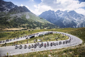
The Legendary Climbs: Australia’s Alpine Proving Grounds
The Victorian High Country’s reputation rests on four major ascents, each offering distinct character and challenge. Understanding their profiles, history, and tactical approach transforms these from mere roads into meaningful experiences deeply connected to Australian cycling heritage.
Falls Creek: The Queen of Australian Climbs
Falls Creek represents the High Country’s premier ascent, a climb that has decided countless races and tested generations of Australian cyclists. From Mount Beauty at 310 metres elevation, the road climbs steadily for 30.5 kilometres to the Falls Creek village at 1,780 metres, gaining 1,470 metres of elevation with an average gradient of 4.8%. Maximum gradients reach 12% in several sections, particularly through the middle portions, where the road steepens significantly before moderating toward the summit.
The climb begins deceptively gently through Mount Beauty’s outskirts, winding through foothill forests as the road follows Falls Creek upstream. The gradient averages just 3-4% for the first 10 kilometres, lulling riders into a comfortable rhythm before the character transforms. Around kilometre 12, the road steepens noticeably, ramps of 8-10% becoming common as the route climbs through dense mountain ash and peppermint gum forest. These towering eucalypts, reaching 60-80 metres in height, create a cathedral-like atmosphere where dappled light filters through the canopy.
The middle section, kilometres 15-25, delivers the climb’s most challenging gradients. Here, the road ramps repeatedly to 10-12%, demanding constant gear changes and concentration. The gradient profile resembles a saw blade more than a smooth curve, with brief respites between sustained efforts. This section tests both physical endurance and mental fortitude, as each corner reveals yet another rise rather than the hoped-for easing.
Above 1,500 metres, the forest transitions to alpine ash and finally snow gum woodland as the treeline approaches. The road moderates slightly in the final 5 kilometres, though still maintaining 5-7% average, allowing recovery before the village. Views open dramatically as vegetation thins, revealing layer upon layer of receding ridges stretching toward the main range. On clear days, Mount Bogong, Victoria’s highest peak at 1,986 metres, dominates the southern horizon.
The summit village, purpose-built for skiing and summer tourism, provides welcome amenities including cafés, restaurants, and accommodation. The sense of achievement arriving here after 1,470 metres of climbing matches anything European cycling offers, with the added satisfaction of having conquered Australia’s most revered road climb.
Historical significance: Falls Creek has featured in the Jayco Herald Sun Tour, Australia’s most prestigious stage race, multiple times. The climb’s reputation was cemented in the 1950s and 60s when Russell Mockridge and other Australian legends tested themselves here. More recently, Cadel Evans, Australia’s only Tour de France winner, trained extensively on these roads, lending them additional cachet amongst aspiring cyclists.
Tactical approach: Start early (7-8am) to avoid the afternoon heat and tour buses serving the ski resort. The first 10-12 kilometres offer an opportunity to warm thoroughly before the gradient intensifies. Pace conservatively through the middle steep section, maintaining a steady rhythm rather than surging on easier sections. Compact or sub-compact gearing is essential, with 11-32 or wider cassettes recommended for most riders. Budget 2-3 hours for the ascent, depending on fitness.
Mount Hotham: Australia’s Highest Paved Road
Mount Hotham presents a different beast entirely, reaching 1,861 metres at the village but with the road continuing to 1,845 metres at the Hotham Heights ski area. From Harrietville at 270 metres, the climb measures 30.5 kilometres with 1,575 metres of elevation gain, averaging 5.2% gradient but featuring numerous ramps exceeding 12%. This combination of length, elevation, and gradient makes Hotham arguably harder than Falls Creek despite its slightly lower summit elevation.
The ascent begins in Harrietville, a tiny settlement that swells with cyclists during riding season. The initial kilometres climb moderately through farmland before entering dense forest around kilometre 5. Unlike Falls Creek’s gradual introduction, Hotham attacks early, with gradients hitting 8-10% well before kilometre 10. The road follows the Ovens River upstream initially before switching to a tributary and beginning the serious climbing.
The character differs markedly from Falls Creek. Where Falls Creek climbs steadily through one valley system, Hotham traverses multiple ridges and gullies, creating constantly varying gradients. Just when legs begin adjusting to a sustained effort, the road pitches up to 12%, forcing gear changes and rhythm disruption. This variability makes pacing particularly challenging, as maintaining consistent power output proves nearly impossible given the terrain.
Around kilometre 20, having climbed above 1,400 metres, the landscape transforms dramatically. The forest gives way to alpine snow gum woodland, then finally open alpine herb fields where summer wildflowers create brilliant displays. The road passes through alpine ski infrastructure, chairlift pylons standing dormant in summer, before reaching the village. The final 3 kilometres moderate slightly, though remain consistently hard at 6-8%.
The summit area offers spectacular views in all directions, weather permitting. To the east, Mount Feathertop rises to 1,922 metres, Victoria’s second-highest peak and arguably most beautiful mountain. Southward, the Bogong High Plains roll toward the horizon. Westward, layer upon layer of receding ridges fade into haze. The alpine village, larger and more developed than Falls Creek, provides full amenities including several cafés, a pub, and accommodation options.
The Hotham experience: Many consider Hotham as Victoria’s toughest road climb due to its relentless nature and constant gradient changes. Unlike Falls Creek’s more rhythmic character, Hotham never allows true settling into comfortable cadence. This demands a different mental approach, accepting discomfort as the norm rather than fighting it. The descent, whilst spectacular, requires extreme caution as gradients that punish climbing reward speed on the way down, with corners tightening unexpectedly.
Historical note: Hotham has hosted multiple editions of the Australian National Road Championships road race, cementing its status as a proving ground for the nation’s best. The climb regularly features in the Jayco Herald Sun Tour, often as the queen stage or decisive mountain time trial.
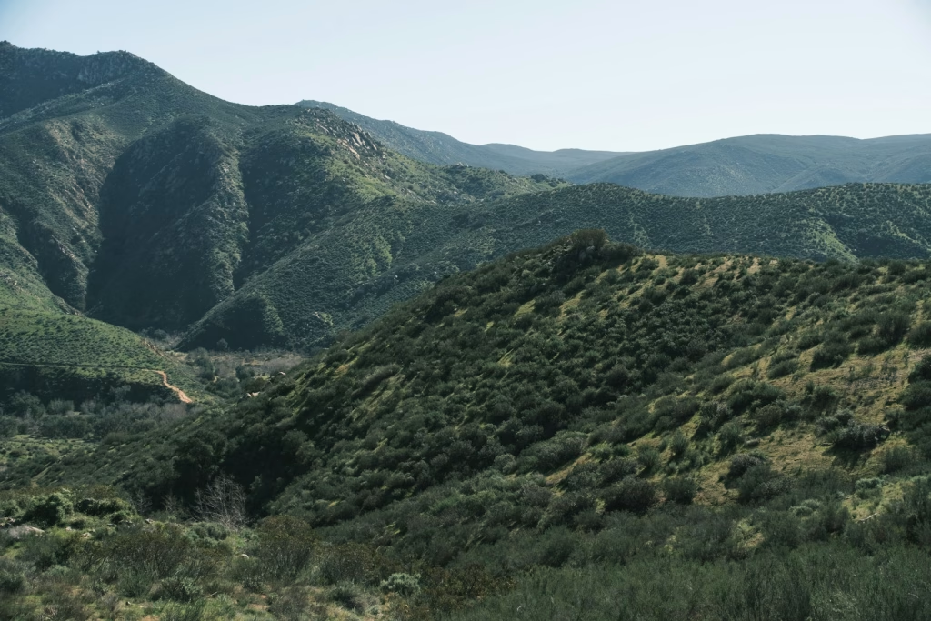
Mount Buffalo: The Gorge and the Plateau
Mount Buffalo delivers an entirely different experience from Falls Creek or Hotham, climbing to a high plateau rather than a village. From Bright, the route measures approximately 30 kilometres to the Chalet at 1,500 metres elevation via the Buffalo Gorge, gaining roughly 1,180 metres. The gradient averages around 4%, making it the most moderate of the major climbs, but the gorge scenery and plateau character create unique appeal.
The climb begins in Porepunkah, just outside Bright, immediately entering Buffalo Gorge. Here, the road clings to cliffside high above the Buffalo River, winding through narrow passages where granite walls tower overhead. The gorge section, whilst not severely steep (5-7% average), demands concentration as corners tighten and roadside exposure increases. Looking down reveals the river far below, whilst looking up shows sheer rock faces disappearing into dense forest.
Around kilometre 15, the road escapes the gorge, emerging onto more open mountainside. The gradient moderates, allowing recovery whilst the landscape transforms. Here, mountain ash forest dominates, with tree ferns creating understorey lushness distinct from Falls Creek or Hotham’s drier environments. The character becomes almost rainforest-like in wetter sections, with moss-covered rocks and trickling streams adding to the verdant atmosphere.
The final section ascends to the Buffalo Plateau, a relatively flat expanse around 1,500 metres elevation where the historic Buffalo Chalet sits. This remarkable building, constructed in 1910, operated as a luxury hotel until 2007, when fire destroyed much of the structure. Now stabilised as ruins, it remains an atmospheric destination and turnaround point for most cyclists. The plateau itself extends several kilometres, offering opportunities for additional riding above treeline through alpine herb fields and granite boulder fields.
The Buffalo character: This climb rewards those seeking gentler gradients and spectacular scenery over pure difficulty. The gorge section provides drama absent from Falls Creek’s valley climbing, whilst the plateau offers a unique high-country environment. Many riders use Buffalo as a warm-up for Falls Creek or Hotham, or as a recovery ride alternative to the harder ascents. The plateau’s relatively flat character also permits high-altitude riding without constant climbing, beneficial for altitude adaptation training.
Tawonga Gap: The Back Door to the Alps
Tawonga Gap offers a quieter alternative to the headline climbs, ascending from Bright to 740 metres elevation over 20 kilometres via Mount Beauty. Whilst modest compared to Falls Creek or Hotham, the Gap provides an excellent training ride with varied gradients and beautiful scenery minus the tour bus traffic.
The route follows the Kiewa Valley Road through agricultural land before steepening through forested sections approaching the summit. The gradient averages around 3.5% but features sections at 8-10%, creating useful interval training opportunities. The summit views reward effort, looking back over the Kiewa Valley toward Mount Beauty and forward toward Bright.
Many cyclists use Tawonga Gap as a loop option, climbing from Bright, descending to Mount Beauty, then returning via the valley floor, creating approximately a 60-kilometre circuit with 800 metres of climbing. This moderate undertaking suits recovery days between harder efforts or provides an introduction for riders building fitness before attempting the major climbs.
Beyond the Major Climbs: The Murray to Mountains Rail Trail
Whilst the alpine ascents dominate headlines, the Murray to Mountains Rail Trail deserves recognition as one of Australia’s finest rail trail conversions. This 100-kilometre paved path, built on former railway corridors, connects Bright to Wangaratta via Myrtleford, Beechworth, and numerous small towns, creating car-free riding through beautiful countryside.
The trail character varies significantly along its length. The Bright to Myrtleford section (24 kilometres) rolls gently through farmland and forest, crossing the Ovens River via heritage railway bridges. This section makes a perfect recovery ride, offering an opportunity to spin legs without significant climbing. The extension to Beechworth adds historical dimension, as this beautifully preserved gold rush town features magnificent Victorian-era architecture and numerous cellar doors offering local wines.
The trail’s engineering showcases thoughtful design, with gentle gradients achieved through careful route selection and occasional cuttings. Maximum gradients rarely exceed 4%, making it accessible to families and less experienced riders whilst still providing engaging riding for serious cyclists seeking active recovery. The sealed surface permits road bikes, though wider tyres (25-28mm) prove more comfortable on occasional rougher sections.
Strategic use: Many riders bookend their High Country trip with rail trail days, using the easier riding to acclimatise upon arrival and spin out tired legs before departing. The trail also provides a rainy day alternative when mountain weather turns foul, as the lower elevation and valley position typically receives less precipitation than alpine areas. Multiple towns along the route offer cafés, cellar doors, and accommodation, enabling multi-day rail trail tours independent of the major climbs.
The Art of High Country Riding: Strategy and Tactics
Successfully cycling the Victorian High Country requires more than fitness. Understanding mountain rhythm, pacing strategy, heat management, and tactical approach separates memorable experiences from survival suffering.
Gradient Management and Pacing
Australian alpine climbs demand different pacing from European equivalents due to length and gradient character. Falls Creek’s 30.5 kilometres at 4.8% average requires 2-3 hours for most amateur riders, but the inconsistent gradient (ranging 2% to 12%) makes steady power output nearly impossible. Maintaining appropriate overall intensity whilst adapting to constantly changing gradients proves critical.
The first third of any major climb warrants particular caution. Starting easier than feels comfortable saves crucial matches for later when cumulative fatigue mounts. The temptation to hammer early gradients, feeling strong on fresh legs, leads inevitably to suffering when the road steepens 20 kilometres later. Professional riders targeting 4-5 watts per kilogram on major climbs, whilst strong amateurs should aim for 3-3.5 w/kg and developing climbers 2.5-3 w/kg. These figures assume proper gearing and a realistic fitness assessment.
The middle section demands rhythm focus. Find a sustainable cadence, typically 70-80rpm for most riders, and maintain it through gradient changes via gear shifts rather than power surges. Resist the urge to accelerate on easier sections, instead using them for slight recovery whilst maintaining steady speed. When gradients ramp to 10-12%, shifting to easier gears and accepting a slower speed proves more sustainable than grinding harder gears at a lower cadence.
The final third permits a slight intensity increase if feeling strong, though avoid pushing into maximum efforts that blow up completely. The satisfaction of a strong finish motivates psychologically, but more importantly, finishing with some reserves left indicates proper pacing for the full climb. Completely emptying the tank suggests starting too hard or attempting beyond the current fitness level.
Heat Management and Australian Summer Conditions
Australian summers bring unique challenges absent from European alpine cycling. December through February daytime temperatures in Bright regularly reach 30-35°C, whilst summits cool to only 18-22°C, with less differential than European mountains. This heat demands aggressive hydration and nutrition strategies, with electrolyte replacement particularly critical.
Start climbs before 8am to avoid the worst heat, targeting summit arrival before midday when temperatures peak. Carry a minimum of 2 bottles on shorter climbs (Buffalo, Tawonga Gap), 3-4 bottles on Falls Creek or Hotham. Water sources exist at some points (Mount Beauty township before Falls Creek, Harrietville before Hotham) but rely on carrying sufficient rather than gambling on finding refills. Dehydration at altitude amplifies altitude effects, creating compounding problems.
The eucalypt forest provides merciful shade on the lower sections of all major climbs, moderating heat exposure. However, above treeline (typically 1,600-1,700 metres), full sun exposure requires sun cream reapplication and potentially a wet bandana or cap under a helmet for evaporative cooling. The Australian sun at altitude proves fierce, capable of severe sunburn within 30 minutes on fair skin.
Heat also affects tyre pressures and braking on descents. Start with slightly lower tyre pressures than European climbs would warrant, as heat expansion increases pressure 5-10 PSI during long descents. Similarly, brake pads heat significantly on long descents in high temperatures, requiring earlier braking and potentially stopping to allow cooling on particularly hot days.
Weather Patterns and Seasonal Timing
The High Country’s weather patterns create distinct seasonality, affecting ride planning. Summer (December-February) deliversthe warmest temperatures and most stable conditions but brings bushfire risk during extreme heat events. Autumn (March-May) provides ideal riding conditions for many, with comfortable temperatures (15-25°C valleys, 8-15°C summits), stunning foliage colours, and generally good weather despite increasing rain probability.
Spring (September-November) presents variable conditions as roads clear from winter snow. September typically sees upper sections still closed, with full opening usually occurring early-mid October, depending on snowpack. Spring brings wildflowers to alpine areas, creating brilliant displays of billy buttons, everlasting daisies, and alpine sunrays. However, the weather remains unsettled, with late snow squalls possible even into November above 1,500 metres.
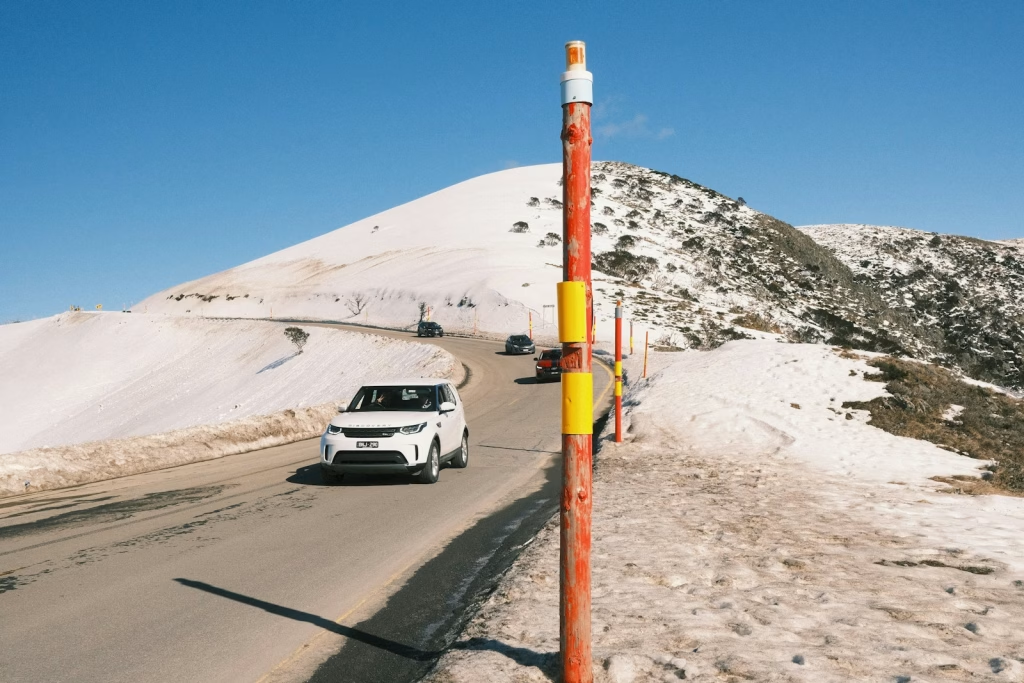
Winter (June-August) transforms the region entirely, with heavy snowfall closing all major mountain roads. Bright itself experiences occasional snow but remains accessible, with the Murray to Mountains Rail Trail rideable year-round for hardy souls willing to brave cold, wet conditions. Most cyclists avoid winter entirely, focusing efforts on coastal or northern Australian destinations until the spring thaw.
Afternoon thunderstorms develop commonly in summer, typically building between 2-5pm. These storms, whilst brief, can dump heavy rain and create dangerous lightning conditions on exposed ridges. Starting climbs early avoids this risk entirely, with most storms clearing quickly to reveal spectacular evening light and rainbows arching over valleys.

Training and Preparation
The High Country’s sustained climbs demand specific preparation extending beyond general fitness. Understanding demands helps structure effective training programmes appropriate to Australian alpine climbing.
Building toward Falls Creek or Hotham requires the ability to ride 3-4 hours continuously, comfortable climbing 1,200-1,500 metres in a single day, experience with gradients exceeding 10%, and functional threshold power sufficient for 90-120 minute efforts. Specific preparation should include building climbing endurance with 60-90 minute threshold efforts, practising sustained climbs rather than short punchy intervals, testing nutrition and hydration strategies under realistic heat conditions, ensuring appropriate gearing, and mentally preparing for hours of sustained discomfort that long alpine climbs inevitably deliver.
Gearing proves absolutely critical for enjoying rather than merely surviving High Country climbs. Standard racing gears prove inadequate for most riders. Compact chainrings (50/34) represent the bare minimum, with sub-compact (48/32) proving beneficial for many. Wide cassettes become essential, with 11-32 minimum and 11-34 or 11-36 for loaded touring or less strong climbers. The ability to spin 70-80rpm on 10-12% gradients proves crucial, as grinding lower cadences for 30+ kilometres destroys legs whilst preventing sustainable power output.
Practical Logistics
Getting There
Melbourne, Australia’s second-largest city, sits 3 hours’ drive from Bright via the Hume Freeway and Great Alpine Road. Melbourne Airport (Tullamarine) offers extensive international and domestic connections, making it the primary gateway. Rental cars provide the most flexibility for exploring the region, though organised tours eliminate driving hassles. Some cyclists choose to ride from Melbourne, a 300+ kilometre journey requiring 3-4 days via quieter back roads.
Accommodation and Cyclist Services
Bright offers extensive accommodation ranging from caravan parks and hostels to luxury mountain lodges, all within small-town walkability. Most properties understand cyclists’ needs, providing secure bike storage, early breakfast options, and washing facilities. Book well in advance for peak periods (December-January, Easter, Autumn Festival in April, and major cycling events).
Cyclepath Bright serves as the town’s cycling hub, offering high-quality bike rentals (road bikes, e-bikes, mountain bikes), expert mechanical service, local knowledge, and social ride organisation. Bright Electric Bikes provides additional e-bike options for those wanting pedal assistance on climbs. Both shops stock quality rental bikes with appropriate gearing for local climbs and can arrange one-way drop-offs for point-to-point riding.
When to Visit
The optimal window runs from October through April, with November-December and March-April offering the best conditions. January-February provide the most reliable weather but bring extreme heat, whilst October and May risk variable conditions but offer spectacular scenery (wildflowers in spring, autumn colours in May). Avoid June-September when roads close due to snow.
Comparing the High Country to Other Ranges
The Victorian Alps occupy a unique space amongst cycling’s mountain destinations. Compared to the European Alps, they offer less severe absolute elevation (1,800-1,900m summits vs 2,000-2,800m+ Alpine passes) but similar or greater climbing distances (30km typical vs 15-25km Alpine climbs). The gradient character differs, with Australian climbs featuring more sustained moderate gradients (4-6% average) punctuated by steep ramps rather than consistently severe European gradients. The landscape presents an utterly different character: eucalypt forest rather than pine, crimson rosellas and laughing kookaburras rather than alpine choughs, and summer heat rather than cool Alpine temperatures.
Against North American counterparts, the High Country offers comparable climbing to Colorado passes but at a lower absolute altitude, reducing altitude sickness risk. The road surfaces generally exceed US standards, with better maintenance and wider shoulders on major climbs. The compact geography permits tackling multiple major climbs from a single base, unlike dispersed Western US climbing requiring extensive driving between major ascents.
For cyclists exploring cycling destinations in Australia and beyond, the High Country represents a distinctly Australian mountain experience that combines serious climbing with unique wildlife, stunning scenery, and cycling culture shaped by generations of riders who’ve tested themselves against these ancient mountains.
Conclusion: The High Country Pilgrimage
The Victorian High Country, with Bright at its heart, transcends typical cycling destinations. This is Australia’s alpine heartland, where generations of the nation’s finest riders have tested themselves against climbs that rank amongst the continent’s toughest. The compact geography enables extraordinary cycling density: four legendary climbs plus countless smaller ascents within 30 minutes of town, an extensive rail trail network for recovery or alternative riding, and infrastructure built around cycling culture that welcomes riders of all abilities.
This is not casual touring. Falls Creek, Hotham, and even Buffalo demand respect, preparation, and willingness to suffer through sustained efforts in sometimes brutal heat. But for those who embrace the challenge, who understand that cycling’s deepest rewards come through sustained effort beneath Australian eucalypt forests and alpine skies, the High Country offers transformation. You descend from Falls Creek or Hotham, not just tired but changed, having joined the lineage of riders who’ve pedalled these same roads for over seventy years.
Whether you’re a serious amateur seeking Australia’s toughest climbs, a touring cyclist wanting a multi-day alpine adventure, or simply someone who loves mountains and the purity of sustained climbing, the High Country delivers an unforgettable experience. The question isn’t whether Falls Creek will hurt, but how you’ll remember that hurt years hence: as suffering endured or as strength discovered beneath Australian alpine skies.
For more inspiration exploring cycling’s greatest destinations worldwide, visit our guide to cycling around the world.

Frequently Asked Questions
What is the best time of year to cycle in Bright and the Victorian High Country?
The optimal period is November through April, with March-April (autumn) and November-December (spring) offering ideal conditions. Autumn provides comfortable temperatures (15-25°C valleys, 10-18°C summits), spectacular foliage colours as introduced European trees turn brilliant reds and golds, generally stable weather, and fewer tourists post-summer. Spring delivers wildflower displays in alpine areas, pleasant riding temperatures, and fresh roads newly opened from winter closure, though weather remains more variable with occasional late snow possible above 1,500 metres. January-February offer the most reliable weather but bring extreme heat (30-35°C+ valleys), whilst October and May risk variable conditions. Avoid June-September when major mountain roads close due to snow.
How difficult is cycling Falls Creek compared to other famous climbs?
Falls Creek ranks amongst Australia’s hardest road climbs and compares favourably to European Alpine ascents. The 30.5km climb from Mount Beauty gains 1,470 metres at 4.8% average gradient with numerous ramps reaching 10-12%. This demands 2-3 hours of sustained effort for most amateur riders. Compared to European climbs, Falls Creek offers a similar length to Alpe d’Huez but with more varied gradients and less consistent rhythm. Within Australia, Mount Baw Baw ranks harder due to a steeper average gradient (12.5% final section), whilst Mount Hotham rivals Falls Creek for overall difficulty despite slightly different character. Critical requirements include appropriate gearing (compact chainrings with 11-32+ cassette), heat management strategies, sustained climbing fitness, and mental preparation for 2+ hours of continuous effort.
Can I do multiple alpine climbs in one day from Bright?
Whilst theoretically possible, combining major alpine climbs in a single day represents an extremely challenging undertaking unsuitable for most riders. Falls Creek alone (61km return, 1,470m climbing) demands 4-6 hours, including descent. Adding Mount Buffalo (60km return, 1,180m) or Mount Hotham (130km return, 1,575m) creates 120-190km days with 2,650-3,045 metres of climbing, requiring 8-12 hours for very fit riders. More realistic approaches include climbing one major peak per day with recovery rides on the rail trail between efforts, or combining a major climb with a smaller ascent like Tawonga Gap (40km return, 400m) for roughly 100km, 1,900m total climbing. This demands excellent fitness, early starts (6-7am), aggressive fuelling (80-100g carbohydrates hourly), proper hydration (3-4 bottles), and realistic self-assessment with willingness to abandon if suffering.
Do I need to bring my own bike or can I rent in Bright?
High-quality rental options exist in Bright, making travelling without a bike entirely feasible. Cyclepath Bright and Bright Electric Bikes offer road bikes, mountain bikes, and e-bikes with appropriate gearing for local climbs. Road bike rentals range AUD $60-120/day depending on specification, with multi-day discounts available. All rentals include helmets, basic tools, and local riding advice. However, serious cyclists planning multiple hard days often prefer their own bikes for precise fit, familiar handling, and personalised gearing choices. Consider rental duration, airline bike fees (typically AUD $100-200 each way), and whether you’re primarily targeting major climbs (own bike beneficial) or mixing rail trail and easier riding (rental perfectly adequate). Cyclepath can arrange transport for one-way point-to-point rides.
What’s the difference between cycling in the High Country versus the European Alps?
The Victorian High Country offers a distinctly Australian mountain experience with several key differences from the European Alps. Summit elevations (1,500-1,900m) prove lower than major Alpine passes (2,000-2,800m), reducing altitude sickness risk but still providing genuine mountain climbing. Climb lengths match or exceed Alpine equivalents (30km typical vs 15-25km), but gradients prove more variable with moderate averages (4-6%) punctuated by steep ramps rather than consistently severe European gradients. The landscape differs fundamentally: eucalypt forest replaces pine, crimson rosellas and kookaburras replace marmots and eagles, summer heat (30-35°C+ valleys) contrasts with cool Alpine temperatures, and traffic proves substantially lighter outside peak season. The compact geography permits multiple major climbs from a single base town, unlike dispersed Alpine climbing. Both offer world-class mountain cycling, but High Country suits those prioritising heat tolerance, Australian wilderness character, and slightly less technical climbing over maximum altitude and Alpine atmosphere.