
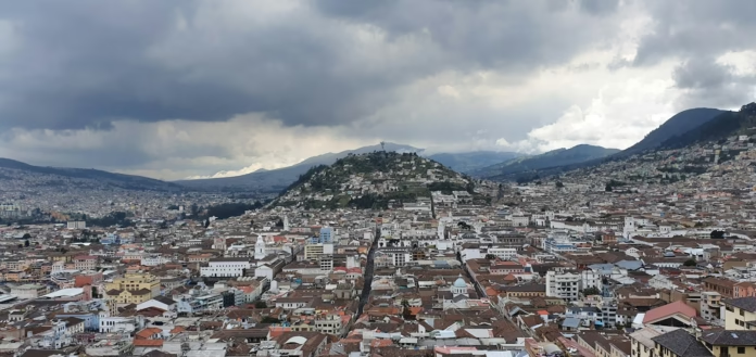
Quito is an unusual place to begin a cycling trip because the first challenge arrives before the road has properly started climbing. Ecuador’s capital sits at roughly 2,850 metres above sea level, high enough for a rider arriving from Britain or northern Europe to notice the thinner air on an ordinary spin. Beyond the city, the Andes rise again towards volcanic passes, páramo and roads that regularly take a cyclist above 3,500 metres. The numbers can make familiar gradients feel completely different.
That altitude is also the reason Quito works so well as a base. It gives riders access to the Pichincha massif immediately west of the city, the eastern highlands towards Papallacta and, farther south, the Avenue of the Volcanoes around Cotopaxi. This is not a destination where a week should be built around collecting famous signposted climbs. The better approach is to use Quito for acclimatisation, choose routes according to traffic and weather, and gradually move into the higher Andean landscape. For other destinations beyond cycling’s usual European bases, see our Cycling in Rest of the World hub.
Cycling in Quito at a glance
- Best for: high-altitude climbing, volcanic scenery, hard road rides and mixed-surface exploration
- Base altitude: Quito is approximately 2,850 metres above sea level
- Best period: June to September is generally drier, with July and August often the least rainy months
- Road bike: useful for selected paved climbs and valley routes, but route choice matters
- Gravel bike: arguably the most versatile option for the wider highlands, where paved roads can give way to rougher surfaces
- Main challenge: altitude, followed by traffic and rapidly changing mountain weather
- Trip length: five to eight days gives enough time to acclimatise before attempting the highest rides
Why altitude changes the riding around Quito
A strong sea-level cyclist should not treat a first day in Quito as an opportunity to test form. The city’s tourism authorities advise visitors to take the first 24 to 48 hours steadily, and that matters even more if the plan involves sustained cycling. Acute mountain sickness can appear above 2,500 metres, with headache, fatigue, dizziness and nausea among the common symptoms. Fitness does not provide immunity.
For a cycling trip, the sensible progression is simple. Spend the first day walking and assembling the bike, then use a short, controlled ride for the first proper outing. Keep intensity low and avoid turning every rise into a threshold effort. Only after seeing how the body responds should the itinerary move towards the 3,500 to 4,000-metre roads. Hydration matters, but so does restraint: a rider who feels poor at altitude should descend rather than trying to ride through worsening symptoms.
This makes Quito very different from a conventional European climbing base. In the Alps, a rider may start a valley ride at 500 or 800 metres and climb progressively. Here, the hotel can already be higher than many celebrated European road passes. The result is a distinctive rhythm to the week, with shorter distances often producing a training load that would normally require a much longer ride.
Pichincha and the western side of Quito
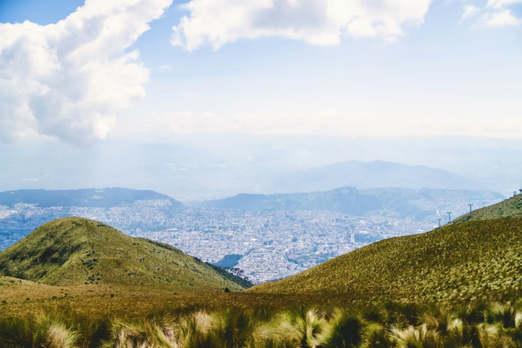
Pichincha dominates Quito’s western skyline and gives the city much of its geographical character. Rucu Pichincha rises to about 4,696 metres, while the TelefériQo climbs from roughly 3,117 metres to around 4,100 metres at Cruz Loma. The summit itself is a hiking objective rather than a road-cycling finish, but the massif explains why roads on this side of Quito gain height so abruptly.
The access road towards the TelefériQo is one obvious climbing test close to the centre. It is steep enough to make altitude immediately relevant, and the urban setting means it is better approached as a short climb than as the centrepiece of a long road loop. Riders looking for a fuller day can instead head north-west towards the rural districts beyond the dense city, where the landscape begins to change from urban basin to cloud-forest foothills.
Nono is a useful name to have on the map. Roads west of Quito can lead towards greener, wetter terrain and eventually the Chocó Andino, with the metropolitan district extending into remarkably biodiverse country. Surface quality and weather become more variable as the routes become rural, which is one reason a gravel bike with robust tyres makes sense for riders who want freedom rather than a strictly paved itinerary.
Papallacta and the eastern Andes
East of Quito, the road towards Papallacta crosses the Andes before dropping towards the Amazon basin. The pass is around 4,000 metres, so this is serious high-altitude terrain rather than an ordinary day ride. From the eastern edge of Quito the climbing is prolonged, and even moderate gradients accumulate into a demanding ascent because so much of the work is done above 3,000 metres.
The landscape is the attraction: high páramo, broad mountain views and a sense of moving out of the inter-Andean basin towards a completely different side of Ecuador. The thermal springs at Papallacta also make the area a logical overnight or point-to-point destination. It is less convincing as a carefree out-and-back road ride, however, because the Quito-Baeza corridor carries traffic and mountain roads in Ecuador demand conservative judgement.
If Papallacta is on the itinerary, a supported ride or carefully planned one-way route is preferable to simply following the main highway until the legs run out. Check current road conditions, start early and have a clear bail-out plan. Cloud, rain and wind can transform conditions quickly at pass height, while a long descent in wet clothing can become cold despite Ecuador’s equatorial location.
Cotopaxi and the Avenue of the Volcanoes
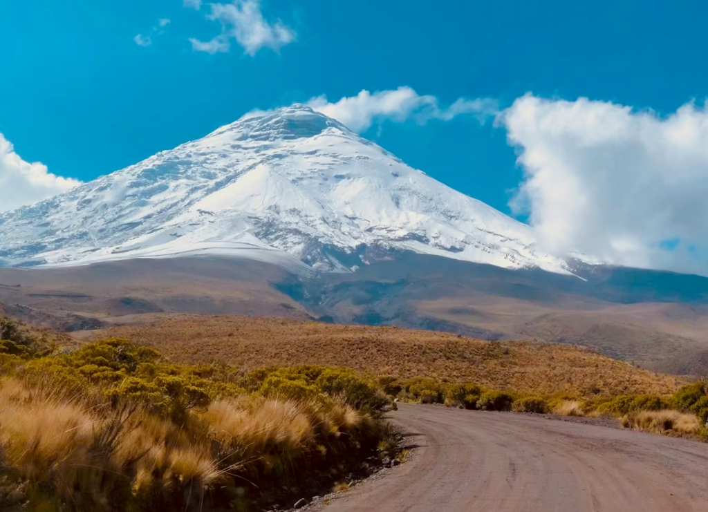
For many riders, Cotopaxi is the landscape they have imagined before arriving. South of Quito, the Avenue of the Volcanoes runs through a high Andean corridor framed by major peaks, with Cotopaxi’s near-symmetrical cone the defining sight on a clear morning. The riding can range from paved loops around Latacunga to rougher approaches inside and around Cotopaxi National Park.
Latacunga is a practical alternative base if several days are being devoted to this part of the trip. Road loops around the city can provide 40 to 70 kilometres of riding with substantial climbing while keeping the rider below the most extreme elevations. That makes them useful as an intermediate step between Quito and a high-altitude volcanic ride. It also reduces the need to spend hours transferring south from the capital before every ride.
Inside the Cotopaxi area, altitude becomes the central fact again. Limpiopungo sits at roughly 3,800 metres, while higher access roads climb well above 4,000 metres. Surfaces can include volcanic sand and rough tracks, so a road bike is not automatically the right machine simply because the route appears as a road on a map. A gravel bike with low gearing and tyres chosen for loose material opens more options and provides a margin of control on broken surfaces.
This is where chasing distance becomes particularly pointless. A 40-kilometre ride at these elevations can be a major day, especially if it contains long climbing sections. Plan around time, altitude and exposure rather than kilometres. Clear mornings also favour an early start, both for views of Cotopaxi and because cloud and rain often build later.
Traffic, road surfaces and practical safety
Quito itself should not be treated like a relaxed European cycling city. Traffic can be assertive, road positioning requires attention and the wider Ecuadorian road network has a serious accident record. British government travel advice specifically warns that driving standards can be erratic, road conditions vary and heavy rain can trigger landslides or closures. Avoiding major roads after dark is sensible, and for cycling there is little reason to be finishing a remote mountain route in fading light.
The Sunday Ciclopaseo changes the equation inside Quito. Sections of the city’s main north-south corridor are closed to motor traffic, creating a much easier opportunity to ride through the capital and get used to the altitude without immediately mixing a hard workout with weekday traffic. If the dates fit, it is an excellent first or second-day ride.
Outside the city, do not assume a secondary road will remain consistently paved. A route that begins on good tarmac may include broken edges, gravel, potholes or construction farther into the mountains. Download mapping for offline use, carry more repair equipment than on a normal club ride and leave route details with someone who is not riding. Mobile coverage should not be the only contingency plan in remote volcanic country.
Security also needs ordinary travel judgement. Quito has areas where theft and robbery are concerns, so expensive bikes, phones and cameras should not be displayed casually while stopped in the city. Use secure accommodation with proper bike storage and arrange transport through reputable providers when moving bikes between the airport, hotel and outlying riding areas. Our broader Travel & Riding Abroad section has more cycling-trip planning guides, while the high-altitude riding in our Bogotá and surrounding high plateau guide provides a useful comparison with another Andean capital.
When to ride and what to bring
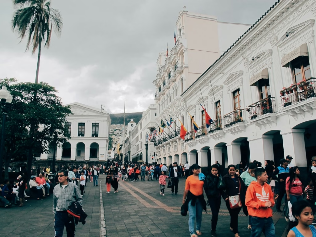
Quito does not have four conventional seasons. Temperatures in the city are relatively stable through the year, with typical daytime values around 17 to 19°C and nights around 8 to 10°C. Rainfall is the bigger variable. June to September is generally the drier period, with July and August usually offering the best chance of clear mornings, while October to May is wetter and March and April are often among the rainiest months.
Those mild city temperatures can be misleading when packing for a cycling holiday. A route climbing another 1,000 metres can move into cold wind and cloud, while strong equatorial sun makes high-factor sun protection important even when the air feels cool. Arm warmers, a packable insulated layer, waterproof jacket, full-finger gloves and a cap or buff all earn their place. For high passes, dress for the descent rather than only the climb.
Low gearing is equally important. A compact or sub-compact setup with a wide-range cassette is far more useful than gearing chosen to look fast on a flat group ride. At 3,500 metres, preserving cadence matters more than pushing a large gear. Tubeless tyres or robust tubes, spare plugs, a proper pump and at least one conventional spare tube are sensible because a long walk at altitude is a poor way to finish a ride.
How to build a week of riding around Quito
A good seven-day trip should increase altitude gradually rather than beginning with Cotopaxi. Use arrival day for recovery and bike preparation, then ride the Ciclopaseo or another short urban route if it falls on the right day. A second controlled ride around Quito’s valleys or lower western roads can test how the body is responding before committing to a bigger climb.
Days three and four can move into the rural highlands, perhaps using the western side of the metropolitan district or a moderate road loop farther south. Only then does a major high-altitude objective make sense. Cotopaxi is the obvious centrepiece, but it should come after acclimatisation rather than before it. Papallacta can fill the other major day if traffic, weather and logistics are suitable.
Leave one day flexible. In the Andes, a rigid itinerary can force a rider onto an exposed road in poor weather simply because a spreadsheet says it is climb day. A spare morning allows the best high-altitude ride to move according to cloud, rain and road conditions. It also gives the body an extra recovery day if altitude takes longer to settle than expected.
-
 Photo Credit: Getty


Quito rewards riders who arrive prepared to adjust. The combination of a capital city at 2,850 metres, volcanoes rising beyond 4,000 metres and roads moving between dry inter-Andean valleys, páramo and cloud forest creates a cycling destination with enormous range. The best trip is not the one with the largest distance total. It is the one that uses the altitude intelligently and gives the high Andes enough respect to enjoy them properly.

