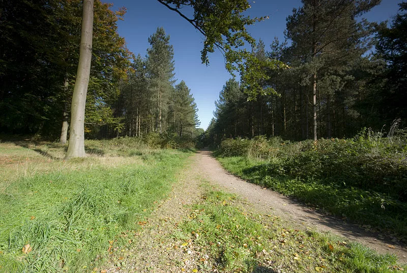
For gravel riding in the Midlands, start by deciding whether you want a relaxed forest loop, a longer railway-trail ride or a demanding bridleway outing. Cannock Chase, Rutland Water and the Peak District can all work, but their routes vary considerably. “Off-road” does not tell you how steep, rough or busy a ride will be.
Choose a published cycling route for a first visit, then add distance once you understand the surface and access. The locations below are starting points for planning rather than a promise that every path within them can be ridden.
Midlands gravel options at a glance
| Location | Good starting point | What to check |
|---|---|---|
| Cannock Chase | Forest roads and easier designated cycling routes | Avoid confusing technical mountain-bike trails with gentle gravel |
| Rutland Water | The signed reservoir circuit | 17 miles without the peninsula, 23 miles including it |
| Sherwood Pines | Maid Marion family cycle route | A four-mile introduction before choosing harder trails |
| Peak District | Monsal, Tissington and High Peak trails | Shared use, access points and any steep connecting sections |
| Malvern Hills | Mapped bridleways and permissive cycle paths | Footpaths and sensitive sites are not general cycling access |
| National Forest | Hicks Lodge cycling routes | Trail grade and suitability for your bike and skills |
Cannock Chase
Cannock Chase is my local area for taking a gravel bike off-road. The forest-road network is the starting point for a gravel outing, with a route chosen to match the conditions and the riding you want. Follow the Dog and the Monkey Trail are mountain-bike trails, not a description of an easy gravel circuit.
Start from the current Forestry England cycling map and follow trail signs and any forestry closures. A wide track can still have loose stone, drainage features or vehicles working nearby. Keep clear of closed sections rather than following an old GPX through them.
Rutland Water
Rutland Water’s full circuit is approximately 23 miles when the Hambleton Peninsula is included, or 17 miles without it. That makes it a useful option when you want a defined ride and a choice of distance. The previous claim of more than 25 miles of gravel around the reservoir overstated both the length and the uniformity of the surface.
This is a shared recreational route, so expect walkers, families and slower cyclists. Treat it as a steady outing rather than a speed test, particularly near visitor facilities. Check the current route map, opening arrangements and any diversions before setting off.
Sherwood Pines
For a specific cycling destination, Sherwood Pines is more useful than a vague recommendation to ride anywhere in Sherwood Forest. The four-mile Maid Marion family cycle route offers an accessible introduction to the forest, with other graded trails available for riders wanting more.
Choose by trail grade and description, not by how much spare time you have. A harder mountain-bike loop is not automatically the next step on a gravel bike. A short first lap also lets you judge the surface before committing to a longer ride.
Peak District
The Monsal, Tissington and High Peak trails are good starting points for less technical riding on former railway routes. They allow you to enjoy the landscape without committing to the rougher bridleways associated with mountain biking. The High Peak Trail also has steep former railway inclines, so check your chosen section rather than assuming everything is flat.
These trails are shared with other users and can be busy near hire centres, tunnels and popular access points. Slow down when passing and take lights if your route includes tunnels. Adding a bridleway link can change the difficulty substantially, so assess those sections separately.
Malvern Hills
On the Malvern Hills, cyclists are welcome on bridleways and designated permissive cycle paths. The Malvern Hills Trust’s walking and cycling map identifies those routes. Public footpaths and visible tracks across the hills should not be treated as open cycling access, and cycling is not permitted on British Camp.
The permitted network can include steep and rough ground. Choose a conservative first loop and consider whether your tyres, gearing and descending confidence suit it. Give way to walkers and horse riders, and do not create a parallel line to avoid mud.
The National Forest and Hicks Lodge
Hicks Lodge gives a more concrete starting point than trying to plan around the entire National Forest. Its cycling offer includes the family-friendly Wood Farm trail and the more demanding Shell Brook trail, with grading information to help you choose.
A marked forest route is useful for building confidence with braking and cornering on loose surfaces. Keep the first visit short enough to assess the bike and conditions, then extend it if the riding suits you.
Access, tyres and route checks
In England, use bridleways, byways and other routes where cycling is permitted, checking local restrictions and closures. Open-access land does not generally provide a right to cycle wherever you choose. A route-planning app is useful for navigation but does not replace an access map.
Set tyre pressure for your wheel and tyre combination, total load and the surface rather than copying another rider’s number. Our guide to inflating bike tyres covers the basics. If your routes involve walking through gates or rough sections, compare SPD and SPD-SL pedals before choosing shoes.
Carry puncture repairs, a pump, water and enough food for delays. Save an offline route and leave time to walk anything beyond your confidence. For a different riding trip, our South West gravel guide explains how the moorland and coastal options differ.
-
 Photo Credit: quentinphotographiebe
 -
 Photo Credit: Getty