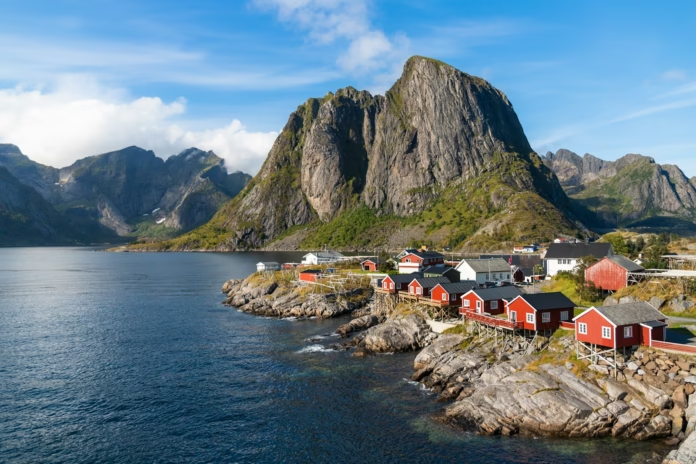
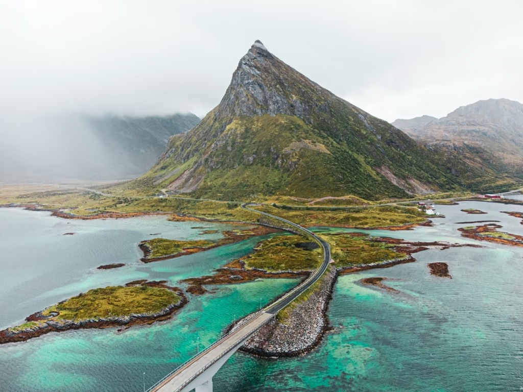
Lofoten looks made for cycling photographs: narrow roads beside clear water, sharp mountains rising almost directly from the sea, red fishing cabins and summer daylight that barely ends. Riding there is more complicated than the pictures suggest. The islands have relatively little dedicated cycling infrastructure, the E10 carries most through traffic, weather can change quickly and several tunnels have to be considered when planning a route.
Those constraints do not make Lofoten a poor cycling destination. They explain why the best trips use the main road selectively and build much of the riding around quieter side roads, fishing villages and coastal loops. The classic line from Fiskebøl to Å is about 160 kilometres, but treating it simply as a point-to-point challenge misses many of the roads that make the archipelago worth visiting by bike.
What cycling in Lofoten is actually like
The terrain is visually dramatic without being a conventional high-mountain cycling destination. Roads often run close to sea level between the coast and steep rock walls, so the challenge comes less from long Alpine-style climbs and more from repeated rolling roads, wind, exposure and the need to manage traffic. A strong headwind can turn a modest coastal distance into a serious day, while the same road in calm conditions can feel surprisingly quick.
The E10 forms the spine of the islands. From Fiskebøl to Å the road is paved and the total distance is roughly 160 kilometres, with no ferry required along that continuous line. There are few cycle paths, however, and road width varies considerably. On some sections there is comfortable space; elsewhere riders share narrower roads with cars, campervans, buses and freight traffic.
That makes route choice important. Lofoten rewards riders who are willing to leave the obvious through-road. County roads and older coastal roads can be much quieter and bring the bike closer to beaches, small settlements and the working fishing landscape. They also make it easier to construct day rides from one or two bases rather than changing accommodation every night.
Fiskebøl, Laukvik and the quieter northern roads
The northern end is a useful introduction because it offers an immediate alternative to simply following the E10. From Fiskebøl, the road towards Laukvik gives a quieter coastal option with open views and considerably less of the through traffic associated with the main route. It is particularly attractive in summer evenings, when riding north and west can put the low sun directly over the sea.
A longer stage can link Fiskebøl, Laukvik, Vestpollen and Svolvær at roughly 68 kilometres. The character changes as the route approaches Svolvær, the largest urban centre in Lofoten and one of the most practical bases for accommodation, food, bike services and onward transport. Svolvær works well for riders who want to combine cycling with hiking or boat trips rather than committing to a continuous tour.
Henningsvær is an obvious side trip from this part of the islands. The fishing village sits off the direct E10 line, reached by a road that crosses low bridges and threads through the coastal landscape. It is popular and can be busy at peak times, but early morning or evening riding can transform the experience. In midsummer, the long daylight means there is little need to force every ride into the busiest part of the day.
Svolvær to Stamsund and the Valberg road
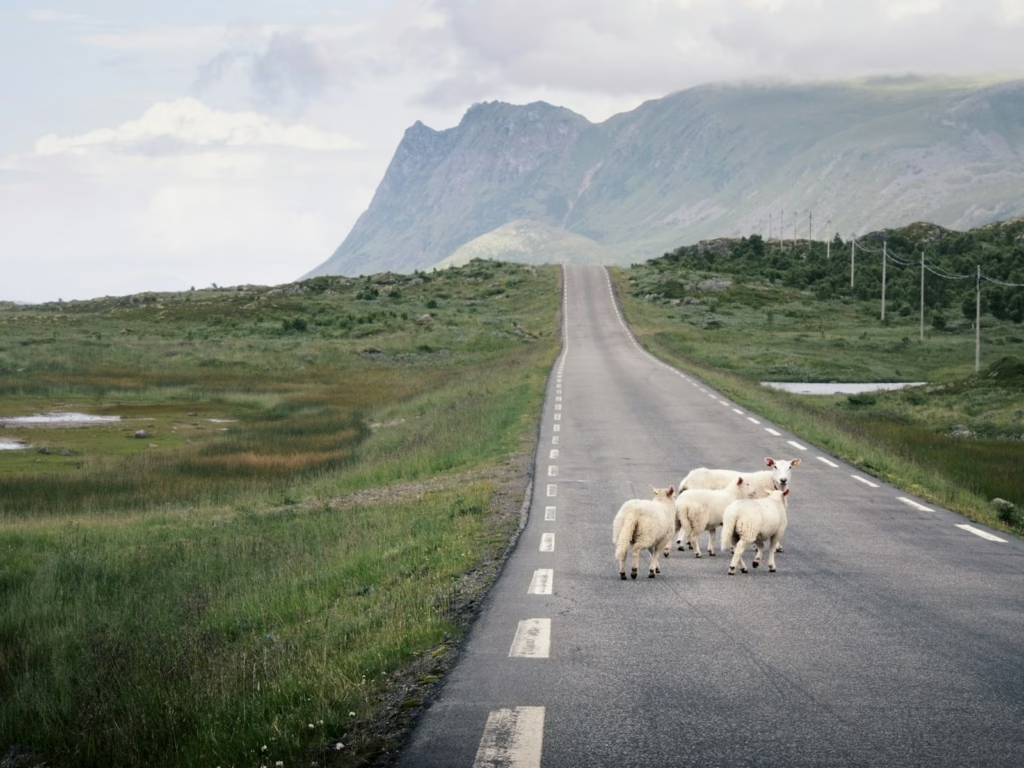
One of the strongest route-planning choices in Lofoten is to use the quieter road network south of the E10 where possible. A Svolvær to Stamsund stage can be built to around 66 kilometres, initially using cycling infrastructure where available before working across Gimsøya and towards county road 815. The Valberg road then provides a calmer alternative to remaining on the main east-west artery.
This is closer to the riding many visitors expect before arriving: smaller roads, sea views, scattered houses and fewer large vehicles. It also shows why a map that highlights only the fastest road between settlements is not enough. A route that looks slightly longer on paper can be substantially better on a bike if it avoids a busy section of E10.
Stamsund is a useful overnight stop and transport point. Coastal ships call there, which can help with one-way ride planning, although timetables and bicycle carriage should always be checked before relying on a sailing. The wider Leknes area provides more services and gives access to both sides of Vestvågøya, making it another sensible base for day rides.
Leknes, Nusfjord, Reine and Å
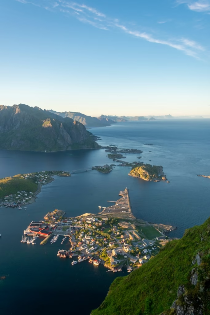
Western Lofoten contains many of the landscapes most associated with the archipelago. Nusfjord, Flakstad, Ramberg, Hamnøy, Reine and Å can all feature in a cycling itinerary, but this is also where road planning needs the most care. Dedicated cycle infrastructure is limited and the E10 can become busy, especially during the July tourism peak.
Shorter rides can work better than trying to cover the entire western section in one push. Roads around Flakstadøya and Moskenesøya provide repeated opportunities to stop at beaches and fishing villages, and the scenery rewards time off the bike as much as speed through it. Riders interested in photography or hiking should build generous margins into distances that would look very easy in a normal training week.
Reine to Å is one of the obvious final sections for a point-to-point trip. It is not a major climbing test, but traffic, narrow road sections and wind can change the effort considerably. Å is effectively the road-end destination for the classic journey through Lofoten, although riders should plan their return transport before arriving rather than assume that a bicycle can simply be loaded onto the next available service.
Tunnels and the Nappstraumen problem in 2026
Tunnels are the main piece of Lofoten-specific planning that cannot be treated casually. The main Fiskebøl to Å route includes ten tunnels totalling about 7.5 kilometres. Good front and rear lights are essential even during the midnight-sun period, and reflective clothing or a high-visibility layer is sensible when visibility changes abruptly at tunnel entrances.
The most important current restriction is the Nappstraumen tunnel. The 1,780-metre subsea tunnel is closed to cyclists during its rehabilitation, so a route should not assume that it can simply be ridden through. Transport arrangements for cyclists have operated during the works, but these are subject to changing schedules and construction arrangements. Riders should check the Norwegian Public Roads Administration’s current traffic information immediately before travelling and again before the relevant stage.
This matters because Nappstraumen sits on the natural through-route between Vestvågøya and Flakstadøya. It is not a minor tunnel that can always be bypassed with a parallel road. A point-to-point itinerary therefore needs the crossing logistics treated as a fixed planning item, not something to solve after reaching the tunnel entrance.
When to ride and how to handle Lofoten weather
Late spring through early autumn is the practical cycling season, but there is no month that guarantees benign weather. Lofoten’s maritime Arctic position means wind, rain and temperature can shift quickly. A sunny start does not justify leaving a waterproof layer behind, and exposed hands can become uncomfortable surprisingly quickly on a wet descent even when the air temperature looked acceptable at breakfast.
July gives long daylight and the most settled tourism infrastructure, but it also brings the heaviest road traffic. June and late August can provide a better balance for cyclists who prioritise quieter roads, accepting that conditions may be cooler and services slightly less frequent. The midnight sun is an unusual tactical advantage for route planning: during the relevant summer period, an evening ride can avoid peak traffic without forcing a return in darkness.
Wind direction deserves as much attention as rainfall. There are relatively few big climbs on the main route, but exposed coastal roads can turn a headwind into the defining physical challenge. If accommodation is fixed, use the forecast to choose which loop to ride rather than forcing a pre-planned route. If touring point to point, conservative daily distances leave room for conditions to deteriorate.
Bike choice, kit and practical logistics
A normal road bike is suitable for the principal routes because the main roads are paved. Wider tyres make sense, however, both for comfort on rougher edges and for riders who want to explore gravel side roads. An endurance road bike or light gravel bike is arguably the most flexible choice. Very aggressive gearing is unnecessary for most of the E10, but lower gears remain useful if side trips add steeper local roads or if luggage is being carried.
Lights should be treated as mandatory equipment rather than night-riding accessories because of the tunnels. Carry a proper waterproof jacket, warm layer, gloves, basic repair equipment and enough food to cover gaps between settlements. Mobile reception is generally useful around populated areas, but downloading maps offline remains sensible when a route depends on a specific side road or transport connection.
Bike rental is available in several of the larger settlements, including around Svolvær, Leknes and Reine, but availability can tighten during the summer. Anyone travelling specifically to cycle should reserve rather than assume a suitable road or e-bike will be available on arrival. Riders bringing their own bikes also need to check the bicycle rules for flights, ferries, buses and coastal ships used in the itinerary.
For accommodation, Lofoten’s rorbuer, guesthouses and campsites make point-to-point riding possible without carrying camping equipment. A two-base trip is often easier: several nights around Svolvær or Kabelvåg for the eastern islands, then a move towards Leknes, Reine or another western base. That structure gives more freedom to change rides according to weather and traffic.
A sensible cycling itinerary for Lofoten
For a first visit, five to seven days gives enough room to see the islands without turning the trip into a race along the E10. One option is to begin around Svolvær, use the Laukvik and Henningsvær roads for separate rides, then move west and ride the Valberg road towards Stamsund and Leknes. The second half can focus on Flakstadøya and Moskenesøya, with shorter days around Nusfjord, Ramberg, Reine and Å.
A continuous Fiskebøl to Å tour is also viable, but three to five riding days is a better framework than trying to complete 160 kilometres as quickly as possible. The distance itself is not intimidating for an experienced road cyclist. The reason to slow down is that the best riding repeatedly leaves the direct line, while weather, traffic and tunnel logistics can all consume time.
Lofoten therefore works best as a cycling destination when the bike is used to explore rather than simply to cover ground. The roads are not high enough to provide a classic climbing holiday and they are not consistently quiet enough to promise uninterrupted riding. What they provide instead is an unusual Arctic touring landscape where side roads, flexible timing and careful logistics turn a busy island chain into a distinctive place to ride.
-
 Photo Credit: quentinphotographiebe
 -
 Photo Credit: Getty